
Google Streetview for Calgary got released today. I ended up blowing away more time at work looking at this that I should have, but oh well, it’s not every day that Streetview gets released for your city, and being a big Streetview junky, I was going to have to look up a few hundred things first before I could sate myself and get back to work.
In the process I noticed a few things. Quite a few things. Some of which I’ve investigated further this evening and am now posting on.
For starters, I’m pretty sure that Streetview plots its’ images automatically by matching the GPS co-ordinates of the road map with the CPS co-ordinates of the car at the time the picture is taken. This should work quite well, until there is a problem with the road map being off. Road maps are off in a lot of places in Calgary due to changes, and I have found that the current Google map seems to be skewed a bit in general.
How do I know this? Well, of course the first thing you do in Streetview is look up your home to see what pictures they caught of it. Hmmm – taken in around June, before I got the lawn fixed up nicely – but at least the hedges are not grown out hugely. So I start surfing around the neighborhood, traveling down the street, turn a corner, when all of a sudden I get a view of a back alley. WTF?! Being near my home, I quickly figure out it’s the back alley of the street I’m surfing on:
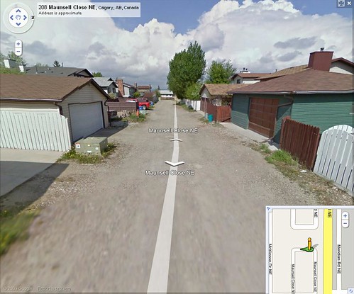
I kind of just assume it’s a bit of a fluke for a minute, when turning another corner, I encounter another back alley, also mis-aligned as being the street. My first conclusion is that Google must have driven a bunch of back alleys as well as the streets, you only won’t see them in Google maps, since back alleys are usually not mapped. I tested this on an exception to this rule I happen to know about, and ‘lo: the back alley was mapped, just like a front street. I later see a comment on a CBC article complaining about how back alleys in Vancouver are all mapped – will have to check this out.
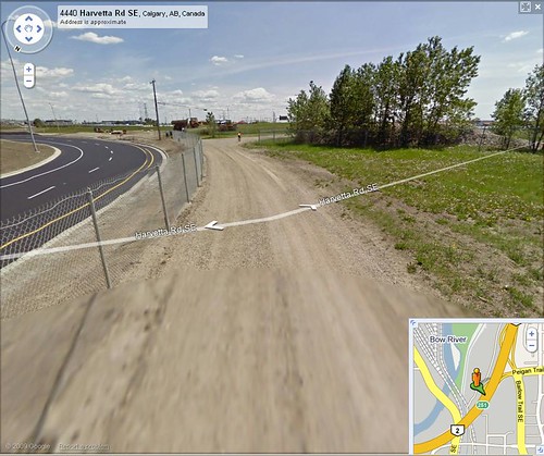
So, taking the previous information once step further, we have the amazing ability of the Google cars to go where no other driver seems to be able to go, for example here:
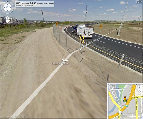
My first thought was WTF – where are we now?
My second thought was WTF – how did the car get here? (You will note the road direction is completely off too)
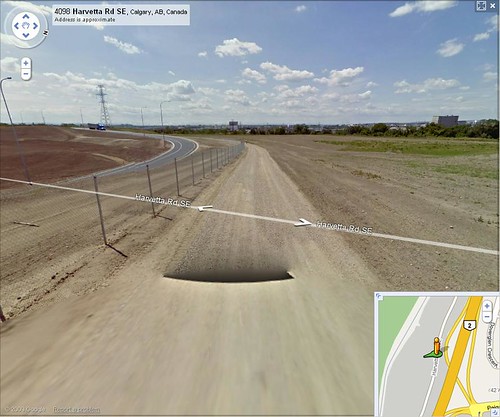
This is a result of road alignment being off, as in – Google does not have the correct street map for this area. The intersection being photographed now has a loop to the north, rather than an on-ramp to the south as listed in the map. It looks like the software Streetview uses to plonk the images down just put the image on the nearest available road, being Harvetta Rd. in this case. You’ll find if you follow Peigan trail west past the #2 on the map, the loop will start and just end it’s images for no reason – well there is a reason – the map goes off to the south for the on-ramp, the actual car went north to start the loop around to end up going south. Some of those images end up on the Harvetta Rd image, see this link for an example (assuming Google hasn’t fix it)
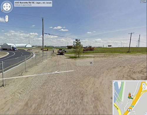
So, at this point, you might be thinking, ‘yeah, but how did the car get there?” Well, at this point I had to figure this out too. You see, “Harvetta Road” road isn’t normally open to traffic. It’s used as a walk path for people that want to take their dogs somewhere where a lot of other people arn’t, or just as a nice viewing path to Calgary’s industrial area. So how did Google’s car get in there?!
Here we have the answer:
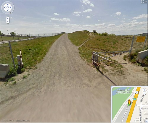
Yes, he saw the gate was open, and that the road was on the Google map, so why not drive up it?
He made it all the way to the end, where the construction guys must have been going “WTF kind of fence building thing is that?”
So, in conclusion for this part; Google – if by some miracle you are reading this, a road update for Calgary would be a good idea, with updated road maps (there have been many changes in two years), a better alignment, and back alleys mapped, if you are going to show us back alleys in Streetview.
Google has crowed about how good it’s face recognition software is for blurring faces. There are examples of it blurring out the KFC logo since it’s colonel Sander’s face, it’s THAT good. Bullshit. It’s just set to be really sensitive, to try and get as many faces and license plates as possible. In statistical terms, it’s set really high so that there are a lot of false positives, while minimizing the number of false negatives. Here’s an example:
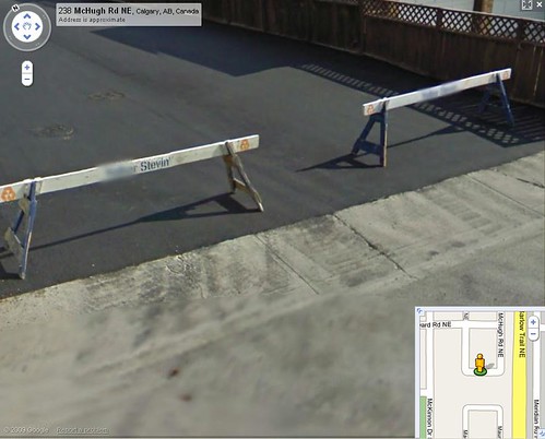
You can see it blurred out “Volter, in Volker Stevin, and the whole text in the second barrier. Why? It looked like a license plate to the software. I can only hope it didn’t look like a face, like in this example:
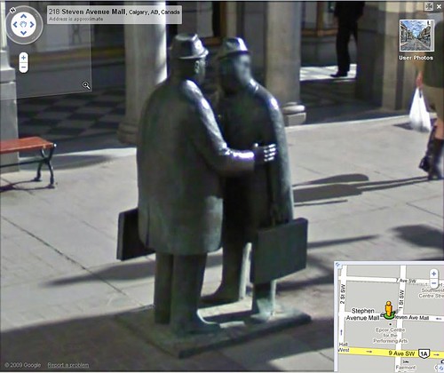
Okay, it’s not the most obvious blurring, but it was the first thing that came to mind for me when testing out the face recognition technology. Oh, and I’ve found a few plates and faces not blurred already. Not many, so Google is doing a pretty good job of meeting the stupid privacy requirements set by the Canadian gov’t., at a cost of having random blurs all over the place in the streetview. They’re everywhere!
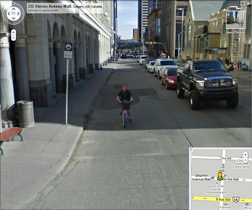
The previous photo was taken on Stephen Avenue mall during the daytime, at about 9:20am. How do I know this? The Streetview car had just passed a clock:
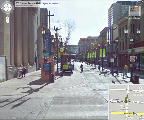
Why do I care what time it was when the Google car took these pictures? ‘Ya see, Stephen Avenue mall is a pedestrian mall during the day, no cars allowed – only in the evenings and at night are cars allowed, to keep down the drug dealers by running them over I presume.
So, how did Google get these images of the street in the middle of the morning? He just drove by the barriers and kept on going:
Approaching the barrier – you can see the no entry sign (6am – 6pm):
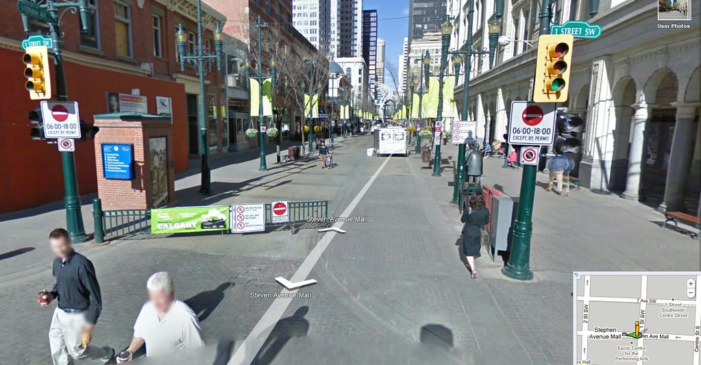
Going by:
and we’re by:
Perhaps someone at City hall was really smart and somehow got the message through that Streetview could come through any time they liked, but I doubt it. If this Streetview driver actually just said “fuck it” and drove around the barrier, I salute you, sir, for having gotten some of the best views of Calgary as a result.
So, to conclude, Streetview for Calgary is awesome. The images are really good. For those that were worried that the images were taken early in the spring when Calgary was still brown and ugly, don’t fret – that’s when they *started* taking images – most of them are during the late spring and into the summer – showing the nice greenery of Calgary at that time of the year. As a bonus, there were several days of really good weather with great clouds in the sky and nice sun – I’m going to do up a compilation of shots from Streetview at some point, show the Calgary and surrounding (west) area captured by streetview.
To finish off, here a couple of extra shots I couldn’t resist:
Riding the pink bike down 1st st. S.W.:
Google car self portrait:

Wow, someone read my blog and referred that streetmen statue to the Herald’s Street View Gallery – thanks loyal reader!
Yeah, I’ve seen a non-blurred face in Calgary and they went down my alley. WTF? What an ugly back of my house shot.