
Eddontenajon Lake
My first stop traveling north on the Cassiar Highway at Jigsaw Lake had been quite nice. I had some potential spots marked on my googles map heading north, but wasn’t sure how far I’d make it up in the little time I had left. I first planned to resupply in Stewart, then head north as far as I felt like in the time remaining before dashing back south. Read on to find out what surprises lay in store for me.

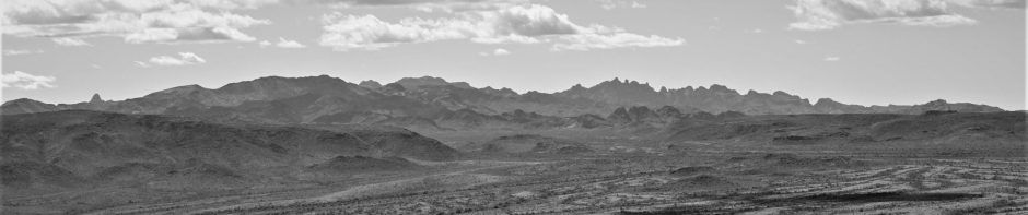
Hwy 31a view
I left my camp at Jigsaw Lake only reluctantly; the lake is pretty and the fishing was decent too. But I wanted to make it at least half way up the Cassiar Highway before turning around. I had business to attend to in Calgary – while I wasn’t on a hard deadline to get back, I didn’t want to be rushed getting things done once back in civilization. I decided to take a side tour into Stewart, which is big enough to at least have basic groceries, but didn’t look promising for ocean camping. I hoped to do a small resupply, have lunch, and tour around town.
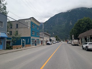 The drive into Stewart takes you off the Cassiar (Highway 37) onto Highway 37a, a branch leading west to the coastal town of Stewart. It is a pretty drive cutting through the spine of the coastal mountains, passing the Bear Glacier and dropping down to the ocean on a winding road with waterfalls and mountains around you. Stewart isn’t as pretty as its surroundings, being a sleepy town looking a bit run down. It was so sleepy in fact that I couldn’t find anything open for lunch other than a hotdog vendor on the main street who was doing a brisk business with the few tourists walking about town. I did manage to resupply in the small grocery store and even managed to score a dessert in the bakery across the street. But overall it was very quiet for what is the middle of summer vacation season in this part of the world.


Bear Glacier
I left Stewart heading back along Highway 37a. On my way in, the view point to Bear Glacier had been closed by some road construction, but I was fortunate that they were done by the time I got back, as I was able to stop and get a few pictures. It’s a pretty good glacier to see from the road – better than the Athabasca Glacier in my opinion. I was also lucky that the grey skies had cleared off by the time I got back there, so the rest of my drive was in sunny skies. I hit the junction with the Cassiar Highway and continued my adventure north.
 I was planning to drive a ways, passing a few lakes along the way. There were no campsites marked on iOverlander that looked interesting, but I was on the lookout for roads heading off towards water. As you head north, you start to pass mountains of the Coastal Range, many with snow on them still at the time I was there in the summer. The highway has had some development in more recent times, so the stories you hear about traveling forever without seeing a gas station are no longer true. Do pay attention to the milage between gas stations; you definitely don’t want to pass by a gas station if you are approaching 100km to empty.

Little Lake spot
While I did pass some lakes on the way up, there wasn’t much for roads leading off towards them. The countryside up here is still pretty undeveloped – there are not a lot of logging roads leading off from the main highway. There is a new powerline that parallels the highway for a good part of the road. That does have many roads leading off to it, you certainly can find spots to overnight along the powerline if you explore a bit. Not having found much, I settled for the iOverlander spot with a small lake I had set as a destination if nothing better came up along the way.

No go say the Beavers
The little lake was nothing special – I didn’t even see a fish rising the while I was there. I did have other potential campers come in not five minutes after I had parked. You could get a second camper unit in there at a respectful distance, which they did – taking the spot on the lake that was noted on iOverlander as being a water truck loading spot. I’d say they were safe for the night they stayed – but I’d not be parked there for a week for sure. The next day, I explored down the forestry road with my motorcycle. I didn’t get very far as beavers had dammed off the creek, building right across the road only a klick down from my camping site. There looked to be some potential spots on the other side of the dam, but there was no going over there unless you wanted to wade in the water and climb over the dam.

Three bears and a cyclist
As I was thwarted heading down the forestry road, I decided to explore north on the Cassiar in advance with the motorcycle. I could see a few of the potential spots along the powerline, so I decided to ride up the highway a bit and explore a couple of offshoots. Upon arriving at the highway, I was surprised to see not one, not two, but three bears grazing on the greenery. I was a safe distance away, evaluating if it was safe to pass them on the highway. While looking at the situation, a cyclist comes peddling by going south. I figured I’d be OK heading north as the bears didn’t even look at the cyclist passing by.

By the road start heading to Ealue Lake
I did checkout a couple of spots north of me past the bears. I had been hoping for something by water, but there was thick brush between me and the water. There was an old camp just off the powerline, but it wasn’t anything noteworthy. I was being super vigilant, just in case there were more bears about in the bushes. Between my spot having regular visitors thanks to being on iOverlander, and not finding anything close by on the motorcycle, I decided that I’d head north again the next day. I had researched Ealue Lake, a fair sized lake a little off the highway that seemed to have some good fishing according to the one Youtube video I found. But in my research I also found there had been an access dispute with the natives blocking off the road heading into the lake and to points beyond. It had been settled with court instructions saying if the road was blocked, it could be unblocked again under the supervision of the RCMP. That had been a few years ago, so I figured the current situation was unknown – but caution was a good thing to have heading out that way.

Cultural camp, GTFO.
I left the Cassiar and started down the forestry road to Ealue Lake. There are some subtle signs of ‘unwelcome’ in the area, and I see posts where they would have had a chain across the road at one point. But there was nothing blocking my way now and the road ahead looked good. I proceeded down to my first potential spot I had pinned on the googles aerial, hoping to be able to drive down to the lake and boondock. I found that road, and every subsequent road to be blocked, with a chain strung across and a nice padlock barring my way. There were no signs, but the meaning was obvious. There were additional spots marked off as “Cultural Camp” that were definite no go’s for me.

Close as I got to Ealue Lake
I tried down one less promising road as a last resort, walking a long ways down to the river that was close to the end of Ealue Lake. While I could have camped down there, I wouldn’t even have been by the river as a ditch blocked off access about 200 meters from the river. That explained why the road was so overgrown – it didn’t go to anything anymore. I knew from the aerials that the road continued across the river to connect to a mine road, but that road was private heading onto the mine’s property. I returned to my RV, now having to come up with a plan ‘B’. I had figured something would work out around Ealue Lake, but it was clear the natives didn’t want tourists camping on ‘their’ lake.

Bunch Berries
Looking at my cached google map (useful for when you don’t have a cell signal), I see that there are a couple of recreation sites ahead. Worst case scenario, I’d head up to Dease Lake and camp on the north end of the lake at the recreation site. But there were other potential spots along the way that might save me going all the way up to Dease Lake. Getting back to the Cassiar Highway, I am at the south end of Eddontenajon Lake. It is a fair sized lake that the highway follows on the east side. I am watching for potential boondocking with roads going down to the lake, seeing one just a little too late to turn into it. But there is a viewpoint just up ahead that serves as a good turn around spot, so back I go to head down the road that heads to what looks like a picnic spot right by the lake. There is a garbage can and a couple of picnic tables with a gravel lot that could comfortably hold 4 good sized rigs at least.
 I spot a little side road going off to the south and decide to get out of the RV and take a little walk down there. It turns out the road ends 20m down at a little informal launching spot, with a nice empty camping spot in the trees right beside it. The lake is right there, and I can just get enough open sky if I put my Starlink right by the shore. I know a good thing when I see it, deciding that this spot would get at least a one night stay to see what it was like. It is a little close to the highway so there is some noise, but I’ll take a few people and vehicles for a good lakeside camping spot.

First Rainbow Trout from Eddontenajon

The fishing hole beside my camp
It was a good thing I was there early in the day as other RVs showed up later. I’m sure one of them would have been in my spot had it been available. It certainly meant I was going to have more social opportunities and less solitude for sure. As the weather was calm and sunny, I wasted no time setting up the kayak and getting out for a bit of afternoon fishing. I had only just paddled out from camp through a hole by the shore, turning out into the lake when I had my first fish in the net. It was a nice Rainbow, good eating size and a very feisty fighter too.

Nice haul of Rainbows
The fishing overall turned out to be quite good, although you needed to find the moments when the fish felt like biting. These bigger lakes can be tough to fish with a little boat – you need to hope there are fish where you are at rather than being able to zoom all over the lake. But fortunately, Eddontenajon Lake had a good spots right by my camp. In fact, the locals came by to cast from the shore on occasion. They never stayed long. I’m guessing they knew the fishing was either ‘on’ and you’d get something in a few minutes, or ‘off’ and you might get something in the next hour.
 I ended up staying for several days at Eddontenajon Lake, with the good weather, good spot, and good fishing. The weather got calm enough that I was able to paddle the twenty minutes to get across the lake, where a good sized creek flowed in. The fish were definitely hanging around there, although fishing along the shore near the creek was as profitable as right around the creek exit into the lake. I got out and explored around a bit by the creek. There is a little used camp in the trees there – I’m sure the natives camp here on occasion as it is a good spot right by the creek.

Not agent orange
I had a problem I had not encountered for a long time at this point. I was catching too many fish to stay in my limit. I had switched to a mostly fish dinner menu, which got rid of my Jigsaw Lake fish. They were smaller so I replaced them with the meal per fish size I was catching at Eddontenajon. Even so, I was throwing back fish, including some I regretted as the fishing turned off as soon as I had thrown back a fairly good sized one. But the fish always bit again eventually, so I left the area with my limit in fish. I’d be taking back a good fish haul to Calgary.

Pollen iridescence
There was one peculiar phenomena I saw while at the lake. There was this orange layer floating on the lake that looked like pollen, I thought. But it was in huge quantities, coating the kayak at times with a bathtub ring of orange residue. I  queried the campground host on the north end of the lake when I went over there to dump and get water. It turns out I was right – it is pollen, from the aspens up high on the mountains above us that were just in their spring flowering season. The water has iron in it which gives the pollen its orange color. Even stranger, I noticed that the pollen layer is iridescent at the right sun angle. The light refracted back into its spectrum – how I’m not sure if it is the fine pollen grains or some thin film effect. It definitely was a ‘what the hell am I looking at’ moment, seeing this rainbow layer on the water rather than in the sky.

Some Germans decided this is what you needed to camp in the Canadian wilderness
The fact that I was camped right beside a picnic area / overnight camping area meant I had a lot of company nearby, but not so close that they were in my face. I met some interesting people traveling to/from Alaska. You read that correctly, one couple was returning to Whitehorse (not quite Alaska) after adventuring to points south. I have to say, my impression that Alaska has less to offer than you might think was confirmed. People raved more about the mountains and lakes of the Yukon, whereas Alaska was a lot of boring forest driving. Alaska does have some stunning parts – but they also have a lot of people seeking them out. I was happy to be where I was on what was just an overnight stop for everyone there – for me this was a worthy destination.

Doesn’t get better than a fish dinner overlooking the lake
I had a great time at my little surprise boondocking spot, but it was time to start heading south again. I resolved that I’d be back here again someday to continue my exploration of the area. I had only been on one of the large lakes along the Cassiar Highway, what adventures await on the others I wonder? Join me next time as I hurry south, but still manage to find more fishing!