 I was determined to put my kayak in the ocean this year and at least try and catch some salt water fishies. I had a good lead on a promising spot I should be able to stay at and put the kayak out in the ocean. But putting the fishing line in the water would involve some extra bureaucracy that can be extra challenging to deal with remotely. Read on to see how I did!

A little local flair at the Terrace Save-On Foods
I had accumulated quite a bit knowledge from the locals about where the good free camping is. My questioning closer to the coast had always been if they knew of anything where you could camp by the ocean, preferably where you could launch a kayak. I knew this was going to be a bit of a challenge – everyone wants to camp near water, especially the ocean. I had encountered one fellow at Kitseguecla Lake who grew up in the area and knew a lot of local spots he’d been to over the years. But it had been a while, so he couldn’t really describe all of them that well in terms of where they were. He told me about one place called “X2”, at least that was how I heard it. He knew that one quite well, and described it well enough that I should be able to find it between Terrace and Prince Rupert. The problem was, I wasn’t finding it at all despite my best efforts at map and googles search. I’d actually given up and was looking at recreations sites on the way to Prince Rupert when I spotted it – Exstew River Recreation Site, no wonder I couldn’t find it before! It has a river and a nice hike to some falls, definitely a candidate for a visit.
 He also told me about another spot that I was really interested in because it had free ocean camping. He’d been there quite some time ago, but he remembered the basic layout of the area. I was looking for something down a logging road north of Highway 16, before Prince Rupert, with the site having a long arm going back to the ocean and a side arm to the right, with a creek entering the ocean by the camping spot. That’s pretty much what I had to go on, so it was a bit of a challenge to find it, but find it I did! He was talking about Work Channel, which was a little farther from Prince Rupert than I expected, but no matter, it had proper ocean access!
 Picking between these wasn’t hard – I wanted the ocean access. My hesitation was that it is a 12.5km drive down the forestry road, with dire warnings about a mudslide prone area, according to iOverlander. Also, there wasn’t much else there, that was the only ocean spot to try down that road. As things were dry during the July ’26 I was there, I decided I’d give it a go. The road in was quite good for about 2/3rds of the way in thanks to some active logging which was happening down a branch road to Minerva Lake (more on that later). The road past that was a bit rougher, but your main problem is that it is quite grown in; you will be scraping bush down parts of this road before you get to the ocean.
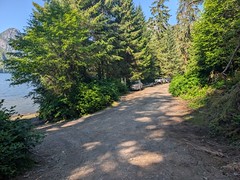
Boat launch to the left
Once I arrived in sight of the ocean, I saw someone camped up ahead. I’m parked in a spot just far enough away that would do for camping in a pinch, so I knew I was staying, yay! But the road continues on a little ways, so I took a walk down it. There were three trailers parked along the side where things widen out at the informal boat launch. The road goes up a steep little hill beyond that with a couple of spots, and a nice spot at the top just far enough away from the launch to cut the noise back, but not so far you’d not want to carry a kayak down. I moved my RV over there immediately – I know a good thing when I see it!
 Overall, there is another nice spot that is more private down the road, but you’ll have fun getting to the ocean through all the bush growing in the area. There are the remains of a corduroy road down there too – someday soon that may deteriorate enough to be impassable. Considering the price of wood, this area is one of the last places in this part of the world you might see a wood road in use. If you’re looking at an aerial photo of the area, note that the road beyond has been ditched and torn up such that even my motorbike wasn’t going through that. Stacks of old corduroy road make excellent barriers to all vehicles.


Same spot as the above picture, completely different situation
The weather was excellent for the northern part of the west coast. Summers here can have stretches of windy and/or foggy wet weather. A sunny calm day on the water should be appreciated for the special treat it is out here. The scenery was gorgeous too – treed and rocky mountains towering around me with a creek coming into the ocean nearby. I was itching to get my kayak in the water and get fishing. I setup the Starlink, getting just enough sky to have a decent internet connection, but phone calls would be iffy for dropped connections. The phone thing was going to come back to bite me shortly.
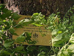
Former site blah blah, vegetation obscura
This site was another one of those BC recreation sites that had been decommissioned at some point in the past. It was the first time I encountered a sign confirming that all facilities had been taken out, use at your own risk. Unfortunately, that includes the outhouse. This area is popular enough that the call of nature for #2 is going to happen sometimes. People don’t know that their discards will float past the boat ramp as soon as the high tide grabs them. Really, this site needs an outhouse, it’s not THAT remote as compared to others in the area. Step up to it, BC rec.

My spot was a large pull out up the road, with just a bit of ocean view
I connect to federal fisheries to get myself a saltwater license. Fishing in BC is a bit of a double whammy – you need a license for both fresh and salt water if you intend to fish in both. The province maintains the fresh water licensing system, the federal government deals with salt water licensing. I’ve previously purchased a federal license online; it didn’t require you to setup a logon or to provide more than some basic information to identify yourself. Not this time, no, I now had to create an account, which my information is stored in. The problem is, the basic information last updated with in 2022 is still online, I can’t create an account with it because the information already exists. I need to PHONE in to get the problem fixed.
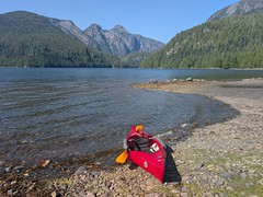 I could have tried phoning and hope I get a connection that holds for twenty minutes. It wasn’t likely based on a phone call I’d been on with a friend the previous evening. I had only one option left: get on the motorcycle and ride back the 12.5km to the highway and a solid cell connection. At least it beat packing up and taking the RV back to the highway, but it was still annoying. I decided that would be tomorrow’s project, the rest of the day would be just a bit of paddling on a very nice day in the ocean.
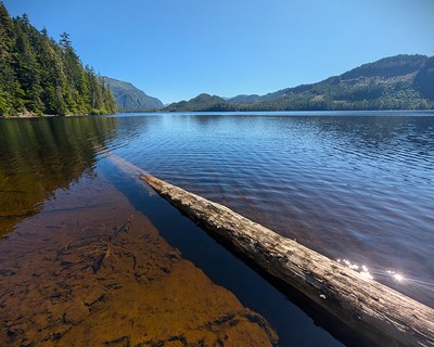
Minerva Lake where the trail comes down
My motorcycle ride day was nice. Once back at the highway, my license was fixed up over the phone really quickly, but still, very annoying. On the way back to the RV, I explored down the left active logging road branch quite a ways, passing Minerva Lake on the way. There is only one spot you could park on the side of the road by the lake, but there is a short steep trail down there you could haul a kayak or canoe down to. There is just enough of an opening at the lake for a launch spot. I might return here someday to try a little fresh water fishing.

One day it’s sunny…
The following day, my annoyance at the delay getting my fishing license returned. The weather was turning grey and foggy, with a light mist in the air. I got myself out on the water just in time for the mist to turn into a proper rain. It was a good thing I’d decided to put on my full rain gear, it was pretty wet out there. At least it was still calm, but there were no fishies to be had. Even with the rain gear, I was starting to get wet in places – my fishing was confined to 2.5 hours of exploring across the channel to the mouth of Davies Bay, with a little shore landing to get rid of morning coffee.

Next day it’s not so sunny
The weather did not improve – plus it got windy. I’m not a fishing fanatic, I want at least reasonable conditions for fishing, although I might put up with a bit more if the fish are biting. But having not gotten anything in my little time on the water, and not really being setup that well for salmon fishing or bottom fishing, I decided a little day hike was in order. I was going to head up the nearby Fortune Creek, to what I presume is Fortune Lake. From the aerial, it looked like there is a clearing to access the lake. I wasn’t even taking the fishing gear along as it was still drizzling wet, and it is a pretty long hike. This is when I found out the loggers had done a really good job stacking old bits of pipe and corduroy road up for the first quarter kilometer: no vehicle was getting around in the thick brush, and nothing was going over waist high stacks of old road platforms.

Some of the easier bits of road barrier thrown up
The weather continued to drizzle lightly, but at least it wasn’t a full out downpour. I crest a ridge and suddenly see a black bear head poke up on the other side. He contemplated me for a second on the road and then took off left of me down the hill to the creek. He had been eating salmon berries, so I’m sure the bear wasn’t happy at being interrupted in his feast. Salmon berries are all over the place there – they taste like a less flavorful rasberry, but still good enough that I sampled a bunch along the way. I noted the bushes were mostly empty around here, away from the campground. The bears were definitely cleaning out this area quite well. I made it within viewing distance of the lake, walking off the logging road into the meadow. But now the rain was falling properly, and I was getting wet very quickly walking in the marshy meadow. My only ‘catch’ was a few low bush blueberries growing in the marsh. I contented myself with the distant view of the lake and made my way back to the RV, making sure to let the bears know I was coming back along the road.

Trailer parking before the launch area. See my RV back there?
While the area is remote, it is not empty of people, owing to the fact that it is one of the few good free ocean boat launches in the area. Considering the narrow road going in, I was surprised at the size of the boats being hauled in here, not just by the locals either – there were Alberta plates on about 1/3rd of the trailers here. You’d better be prepared to backup on the last narrow part of road in unless you have an even bigger RV trailer. I didn’t see any of those, most people came in with truck campers or vans. I would not recommend bringing in a huge trailer here – it’s just a little too uneven a road, with only a few spots you’d even be able to park your beast, never mind getting it turned around.

Kayakers leaving after practicing self rescues
The traffic meant no solitude, but I did have some good conversations with the boaters. In terms of what I could reach with my kayak, I was told that the entrance to Davies Bay was about my best chance for a salmon, trolling around the entrance. They mentioned that small halibut and rock fish might be found in the shallower end of the main bay, which makes sense to me. I just didn’t have good enough weather to give it another go on the fishing! The big boats were mostly heading out to the end of Work Channel, where it meets the ocean not far from the Canada – Alaska border. Fishing was good out there, people were bringing back Chinook, Coho, and Halibut. I did meet a couple of kayakers – they were an experienced paddling couple trying out their new gear for the first time. I watched them do a self rescue – where you get in the deep water and try and haul yourself back in the kayak. It is not an easy thing to do, but both managed it, at least in the calm waters. I could not do a self rescue in my kayak. The only video I’ve seen of it involved going over the tip of the kayak and not the side, an even more difficult prospect!

Trucks and salt water don’t mix, the better launch is to the right off the picture
Most people launching or taking out there boats did it at high tide or low tide, which is the best time in this area. The mid-tide is a bit tricky, as there is a flat area that becomes exposed as the tide heads to low, but at mid-tide, you would drive a long ways in before you hit deeper water as one truck found out. He claimed previous experience at launching here, but I’d say he only knew enough to be dangerous. His friend had not launched yet, so I pointed out the spot off to the right when you are facing the ocean, you can drive to it at mid-tide and there is a less obvious spot to launch that does go deep right way. I knew all of this from beachcombing there for a my stay during all levels of tide, plus my experience helping my Dad launch his boat. I know what you are looking for in a boat launch. Anyways, buddy did take my advice and had no problems getting in at the alternate launch spot. I now was a ‘local’ with local knowledge!
As the weather wasn’t looking to improve in the next few days, I decided to leave my one and only ocean spot of this trip. There wasn’t much more for hiking in the area and I was getting tired of the rain. I was going to make a quick tour of Prince Rupert, then head back inland, to finally start exploring the Cassiar Highway. Join me next time for more adventures.