

My first full day on Kootenay Lake dawned misty and grey, but no rain! I’ll take it at this time of the year, the wet season has begun here and anything “not raining” is a win for weather. It will be a good day for a hike. I have several sources, of maps, even some old school paper map books of the area. I have found something interesting in my “Backroad Mapbook”. We will use that for the first hike to go on. But the bridge I need to cross to to get to my destination is supposed to be out. Will I be able to get there?
The “Backroad Mapbook” had a mark on the lake shoreline one valley to the north of me marked “pictographs”, with a rough road marked as going to it. I can only think they mean petroglyphs, so based on that little mark, we will see if we can find these “pictographs”.
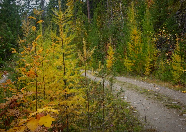 |
| Larches just turning down by the water |
The walk started with a climb up the road from the campground, a steep but short little jaunt back to the four way junction. One route takes you further up the lake to the next valley, and from there, down to where the petroglyphs are supposed to be. Walking north, I start climbing. Down low here, fall is still early – the larches are just starting to turn color. Who needs to line up to see the larches at Lake Louise (in Banff National Park) when you can get all the larch color you want walking along these roads in the Kootenays?
I climb up quite a ways from the lake. I’m still not in the best of shape yet, so I’m not too pleased about having to go down all this way again to the lake, then have to repeat the process coming back. But that’s hiking for you. Eventually we drop back down to the Powder Creek, where the bridge is supposed to be out. A barrier has been placed telling you the road is closed. I head past that and then encounter a much more substantial barrier, a big pile of rocks across the road. Nothing bigger than a quad getting past these rocks!
 |
| Bridge is still there, just not suitable for vehicles? |
Reaching the bridge, I see it is still there, just with a bridge closed sign lying on the middle of it. The bridge looks fine, at least for my weight. Perhaps there is more subtle structural damage that might cause a collapse, say if my RV went across it. But I pass without issue, not seeing any obvious signs of bridge weakness. I continue up the road, going away from Powder Creek. I am expecting a junction with a road going down shortly and am not disappointed.
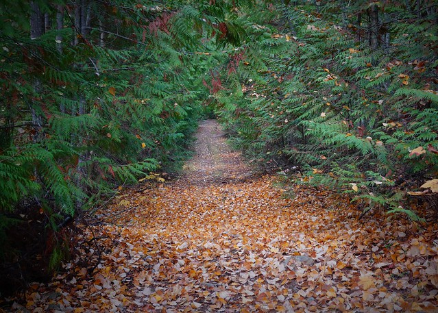 |
| Leave strewn path to the petroglyphs |
The road leads down at a gradual pace, staying away from the drop down to Powder Creek. I am in thick forest, with stretches of leaves along the way. It is quiet and muffled walking here. But for a minor logging road, this is very well kept. There are no trees across the path, and I see evidence of recent clearing. Perhaps this is being maintained for access to the petroglyphs? (I find out later that a recreation area is supposed to be down there somewhere, the road was probably being maintained for that before the bridge was closed.)
The road continues down a long way – the bridge crossing Powder Creek was way up the valley. There is the occasional view as the road comes close to the cut that Powder Creek flows down, but other than that I see little. I arrive at the lake shore, and start exploring the immediate area.
 |
| Not a Petroglyph |
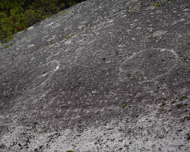
The first thing I spot close by where the road ends is these bright white marks among the mosses and dark rock. I’m doubting they are petroglyphs – too much just a big block of white, and fresh seeming. What I’m looking for will be more subtle, and typically have distinctive forms in lines, waves, Vs, or geometric forms.
 |
| View looking south near the Petroglyphs |
–
 |
| View looking north near the Petroglyphs |
Looking both directions, I decide to proceed south along the lake. There are more promising rocks that could have the markings I am looking for this direction. But there are a fair number of rocks and I cast about for a while looking here and there.
 |
| The petroglyphs |
–
 |
| The whole rockface with the petroglyphs |
Eventually I do find the petroglyphs, just a single pair circles with radiating lines inside from the looks of it. While it is only a small fraction of what you can see down in Arizona, I am still pleased with the find as I had not been expecting anything at all here on Kootenay Lake. I am also pleased that no one has defaced these with modern scratching – let’s keep preserving the native art as it was made.
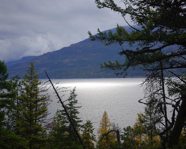 |
| Light on the lake |
I had been watching the sky as it had been threatening rain for some time, but the sun spot on the lake tells me I still have some time as I hike all the way back up to the forestry service road, then back to my camp. The rain starts shortly after I get back, what good timing!
 |
| Kootenay Lake visible as you climb up Bernard Creek valley |
There were some other hikes while I was in the area. The other major hike was up the logging road that follows Bernard Creek up it’s steep cut, into the valley above. I was hoping to make it into the valley proper in the higher country, but still still below the snow line! The views were non-existent until you started getting pretty high up – standard for the area where the lush growth covers everything except the steepest slopes.
 |
| Mushroom underside, kicked over by what though? |
But there were a few things to see in the undergrowth, like this mushroom, hopefully kicked over by something that wasn’t a bear. But I was doing my ‘here bear’ conversation as I was going up, reciting all the words that rhymed with bear, and putting them together in silly verse like ‘no bear would eat me rare, ‘cuz my meat is too sweet”
 |
| Old Growth Forest near Bernard Creek |
After a long climb up the trail leveled off, then gradually descended down to the creek. I had decided this was a far as I would go, as the day was getting on, and more rain was threatening. Close to the creek, no logging was done and these huge old growth trees remain. They are awesome sights, and I can certainly understand why people start protesting when a logging company wants to take out a bit more of what little is left.
 |
| Bernard Creek Bridge gone |
Arriving at the creek, I see no bridge. Looking at the rushing water and the huge boulders, it seems my decision to end the hike here was going to be forced on me had I not decided already this was the destination.
 |
| Much roaring water going by, not crossing this! |
The rushing water sound is soothing, yet dangerous at the same time. I wouldn’t hear anyone coming until they were upon me, nor would any bear hear my silly song with all the water noise. I inspect the area carefully to make sure no bear is lurking about the water before enjoying the sight and sound for at least a few minutes. But I’m not going to linger in case something comes down to visit.
 |
| Selfie with the roaring creek |
Content with a selfie, I trudge back down the valley, beating the rain back to my RV again! The next couple of days are rainier, with me also suffering from and old man’s ailment, hemorrhoids. Just the condition I need for hiking. So I stick closer to home, hiking to Garland South, aka Bernard Bay campground, only a short distance away, plus a little hike up a small dead end logging road near camp. At least I am fortunate that I actually have ointment to treat hemorrhoids, having suffered previously. I’m feeling a little sorry for myself, one of the reasons I got out here as young (for a semi-retiree) as I am, is I wanted a few years of “condition free” status to explore the world before things started bogging me down. It’s not the end of the world, I know – but between that and the cold raining weather it leaves me a little glum.
 |
| Clearing skies |
 |
| Clearing skies reveal the snow is getting lower |
But the rain does let up at times, letting me out for little hikes, which is all I should be doing anyways. The cold and snow topped mountains remind me winter is coming and I need to plan my exit from here soon. I see weather warnings for mountain passes being treacherous with snow. But the snow is clearing and I look to have a good window of a few days to travel west towards Vancouver.
 |
| Bernard Creek at outflow to Kootenay Lake, fishing spot |
I spend the less rainy bits doing some fishing. I don’t really expect to catch anything – while it is possible a small rainbow or two might be trolling around the creek entrance for some food, it’s not likely this time of year. Most of the real fishing here is done trolling on larger boats. But it whiles away the time and you never know. I’ll keep casting, contemplating my next move out of the Kootenays in the meanwhile.
