
 My new spot was on the other end of the “time since logged” scale – an area that had been logged 30 odd years ago. It looked like a forest rather than recovering logging scar. I was at one of the few large clear areas remaining – a former aggregate pit that was behind my rig. But how would hiking be down the roads, I wondered, too much brush to deal with?

The pit is right behind my rig, filled with water
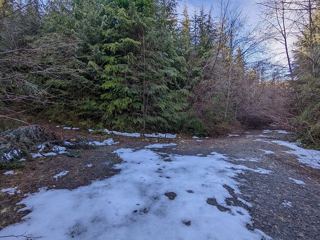
The old pit site was nice in that the holes left behind fill with water often, so I had a free source for things like window washing. Traveling down the gravel roads puts a lot of dirt on my big back window, so I like to clean it if at all possible once I’m settled in. What was not so nice was that there was more snow here than my previous spot. I still had snow on my site, but not very deep thank goodness! But I was tired of the snow and just wanted it gone, period.

There was still some snow on the roads here too, but it was minor compared to the brush and trees down. I decided for my first hike to try and get to a little unnamed round lake not too far away, near one of the branch roads.

Left to ocean, right to small lake and newer logged hills
The initial part of the road was not too bad walking at least. There was more brush and one more low hanging tree my RV might not fit under, but other than that I could make it all the way down to this junction. Things were super wet this morning, the dewy brush picture introducing this entry was the shrubs on the right of this junction. I could see ahead to the left a tree on the road, a sign of what was to come.
I turned right and headed up the road. There was more brush and trees on the road. I was pushing branches aside and getting wet in the process. But it was not slowing me down too much at this point, I was just annoyed at getting wet.
Left to small lake (very brushy road), right to newer logged hills
The second junction did not look so good. Dense brush covered the road to the lake, plus there were downed trees I’d have to go over or under. But the aerial showed the lake was not that far – it was worth a try and getting wet. As I proceeded down the road, the going got more and more difficult – the trees to crawl under and climb over were especially challenging. Finally, I get to a massive pile of trees on the road. Looking past it, I see yet more massive trees on the road. But the sides are all mature forest here. If I can get through the ditch perhaps I can walk through that paralleling the road.
Getting through the ditch isn’t easy, but I scramble up the other side into the forest. It is indeed easier walking, but still slow. I climb up a hill, then hit more brush ahead of me, looks like another branch road. Hacking my way through that, I see the main road is not as bad again, so continue down that. I can see on the aerial now that I’m almost as close as I’m going to get to the lake. Past another road junction, I dive into the bush, in a spot that seems a bit more open at least. I’m marking trees with the cleaver I bought with me to hack bush – the lake is close but not close enough to see – I could get lost even in 200m of hacking my way through the bush. I pass through a bit of easier to walk old forest, then younger trees, then back into the bush. I know the lake is close because I see the trees opening up ahead.

Hacking my way forward ever so slowly, I finally see the lake ahead, and a little clear corridor I can walk through without hacking bush! The going is still tough – I find myself standing on a big log looking down to the lake, but the drop is too far to climb back up. I end up re-tracing my steps and turning left rather than right at a group of large trees.

Cedar and hemlock tress together are common here
The logging companies are not supposed to cut trees right by any lake or stream, to protect the waterways. These large trees are a cluster near the water. They give you some sense of what stood all around here at one point.
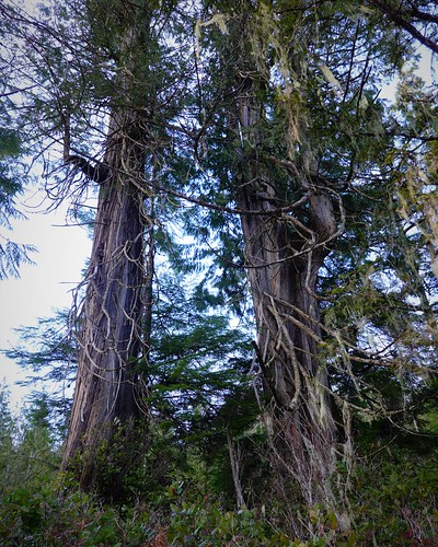
The two cedars are particularly massive. The are impressive for being so close together and still having a lot of green foliage low down. I would guess the lack of competition from other trees encouraged growth low down as compared to the normal dark forest where high growth is the only thing that reaches the sun. The grouping of trees makes a good landmark as I explore the shore a bit, looking to see if any fish may be rising.

Dead calm lake
The lake is still, like a mirror – no waves, and no fish to be seen. I’m doubting anything is in here, it is not very accessible and not near the towns. There is no stream for salmon to come up here that I can see.
I turn back, heading up the little clear corridor first. I marked the last small tree before entering the corridor, but it still is a little hard to find. Good thing I marked it with a bit of flagging tape too, I knew coming in this spot would be hard to pick out walking back. I grab my tape and continue into the bush. I follow my marks back. There is a bit of snow here, so I have the occasional foot print to help me too.
I reach a point where I am going from young trees back into the older trees. But I can’t find my next mark. I cast out in one direction, making sure I don’t lose sight of my last mark. While I have a general idea of the direction to get back to the overgrown road, I’d rather take the shortest path possible through the brush.
I see nothing, and return to my last mark. The key at this point is not to panic. I knew there was a mark somewhere near – I had marked twice as often as I would think I needed to make sure I could see the next mark coming back. I took another look around me and this time spot the next mark to my left. I had made a bit of a turn here coming down it seemed. Had I kept going straight, I might have paralleled the road for a while before eventually intersecting it at an angle.
My trip back was a little less hacking, as I had already cleared many branches away, but still wet. This had not been a fun walk to the lake for sure. I decided that returning with a fishing rod was not worth the effort – having a pack and rod sticking out would have made getting in even more difficult, and I was not confident that fish were to be had at this lake. There were other places to try for fishing that were easier to get to and more promising for fish.

Stephens Lake iced over
So next day I took a walk down the Coal Harbour Main logging road to Stephens Lake, at least I assume that is the name of the lake as it is the origin of the creek that I do see named on my topo map of the area. It was a chilly morning, but I was not expecting it to be so chilly as to have frozen the lake over. I ended up spending a bunch of time on the informal little dock throwing rocks in the water, making myself a little open patch to cast into. But it wasn’t much of an area. I was not surprised to come back with no fish. Having seen signs of fishing here, I resolved to come back on a warmer day and try in open waters.

Long dock on Quatse Lake. The dot is my pack at the end for scale.
In the meanwhile, I occupied the rest of my day with a hike to another not so nearby lake, Quatse. This is a fairly large lake for the area, and also serves as the water source for nearby Coal Harbour. In my explorations for camping spots, I had driven by the road access point for the lake. At the time, the gate was open, which confused me, as the googles happened to have Streetview of the road going by with the gate closed. I wanted to verify the gate was still open, and then see about boondocking spots, possibly close to the lake.
I arrived at the gate, and found it to be closed now. Passing through, I could see why. There are water tanks for the town and what I presume is a water treatment building just beyond the gates. Better to have a little extra security of a gate. But that means that everything past is no camping either. Oh well, you can’t win them all. I walk down to the lake and find the dock extending way out into the water, and what I presume is the pumping building for drawing water from the lake to the treatment plant. I was not surprised to see the dock as the googles aerial showed it as well.

Being way out in the lake was nice for casting, but I still managed to lose a lure casting towards a logged area that might have some fish under it. I didn’t hit the log, but whatever was under the water in front of it now has a nice Kamlooper lure hanging off of it. The weather was blustery with a rain squall coming through. I sheltered under a big log at the shore. Being a long walk, I only fished an hour before heading back. I wasn’t going to push it for no fish so far and not so great weather.

Off a siding on the Coal Harbour main
So that was a ‘car wreck’ of a day – not the best outings, but not the worst. I mean, the junked car on the side of the road made for an interesting picture at least. Of course, the sun comes out as the day is ending. Rain was coming in for the next day, time to hunker down in the RV. One other good thing about my site is it has good cell signal so I can access the internet to entertain myself. Next time, more hacking to get to the ocean and an aborted site move!
