
 I was on my own again, exploring the north east end of Kofa National Wildlife Refuge. I had explored a bit of the west side previously, but even there I only scratched the surface. Kofa is big. I started out camped on the edge of the park, with the plan being to take the motorcycle into the park and see if there was a better spot I could drive to with the RV. Read on to see what I found!
 One advantage of camping outside of Kofa is that you are not subject to its rule of no camping more than 100 feet from the road. The north side roads are not that busy, but there are a few vehicles everyday and the occasional ATV caravan to really make a ruckus. My spot outside was just north of the fence marking the refuge border. A cart path followed the fence, which I took for 200 meters then turned north to park on a bit of desert pavement. I had been excited to see that no one was here. The nearest camper was a half klick north of me by the first bit of basaltic rock hump you pass on the way south. I could not even see them from my spot, but I could see the $$$Van$$$ approaching me through the desert, having followed little cart paths from the north camp to where my camp was.

Camp spot just outside of Kofa North
I was cursing them from inside my vehicle – go away, I thought, there is a lot of desert around here you can camp in without being within my sight. They must have gotten my mental vibe because they turned around about 150 meters from me and went back the way they came. They probably were surprised that there was someone way out at the end of the cart paths they had followed, when in reality they are connected by a loop from the north end to the south end. At any rate, I was much happier to be far from the main road with no one in sight of me. A bit of a solitude recharge was in order after all the people visiting I had been doing recently.

Cool wash leading to the basaltic humps
My only disappointment was that the mountains of Kofa were about three klicks away from me – quite a bit of walking first if I wanted to climb them. But closer to me were a bunch of basaltic humps. I decided to check them out as they were only about a kilometer away from me. I walked down the cart path that paralleled the north Kofa fence border, then followed a wash that was heading towards the humps.
 As I approached the humps, I could see they were composed of a bunch of fist to beach ball sized basaltic rocks. It was a strange contrast – light colored sands with what looked like a pile of dark rock strewn over top of them in smaller and bigger piles in the region. While I know there is a volcanic origin and these are the erosional remains, to a spiritual person they would look like gohd had decided to dump dark rocks in piles around the area.

Abrupt transition to boulders
I approached the first hump and could see that the transition was stark, but not quite all dark boulders. There were patches of sand in between some of the rocks, and larger patches of sand in the boulder field. Climbing the hump I selected was still treacherous though – you had to step on larger rocks that may or may not be stable. Having spent a lot of time in the Canadian Rockies traversing scree slopes with similar rocks, I felt a little bit more confident than the average soul stepping on the rocks, judging which ones were stable to step on. A general rule is the bigger the rock, the more likely it is solidly placed. It’s the border line small rocks that look stable that get you a sprain or broken bone if they move on you suddenly as you step on them.

View from the closer to the farther hump from camp
But there was no mishap this time, I made my way to the top without having a rock try to take me down. These are not tall mounds so the view isn’t that spectacular. But it is cool to look from one hump over to the other one nearby and see the scale of these abrupt hills in the desert. Even on googles aerial, the rocks are dark blotches against the light sand that make you go ‘WTF is this’? In fact, that was why I was parked where I was to see them from the ground for myself.

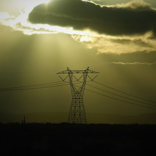
Sunset last day at my north camp
But there was not much else in the area to explore, so I took the Grom motorcycle into Kofa my second day there to explore for a better camp closer to the Kofa/Water mountains. I found several potential camping spots that are within 100 feet of the road (I’ll quote imperial if those are the units used by my source). I decided that the junction of Pipeline and Kofa Manganese road had the best potential. It still had some cell service, was close to the Water Mountains, and I could get right out to 100 feet away from the main road there in a couple of spots. My only decision was whether to camp off of Kofa Manganese road a bit further south of the junction, or right at the junction, north of the pipeline road. The cell service was better to the south with less traffic on that road, but the north was closer to the mountains.

Spot 2 closer to the hills
I decided close to the mountains was the way to go – I’d put up with a bit more traffic and lesser cell service to shave a half klick of walking off every time I went to the mountains. So the following day I packed up the RV and took the road into Kofa. It isn’t the best road, but still navigable by anything other than really low clearance vehicles. The road gets better and worse as you drive down, but there is never a danger of getting stuck in dry conditions.

Flowers starting to bloom in the washes
Having only driven twenty minutes into Kofa for my second spot, I had plenty of time for a hike that day. There were basaltic mounds to climb, with a large wash to explore along the way, so off I went! I had to cross the Alamo wash, probably the largest wash I have seen to date, with multiple sand channels to cross. Every time I thought I had crossed it, another sand channel appeared for me to navigate across. Spring was starting in this part of the world. There were nice bunches of yellow flowers and purple lupins just starting to bloom. I was not that far from having to leave the desert, but spring was still far away where I had to go back to Canada. I put that thought out of my mind – spring was here and I was going to enjoy it!

Dramatic mountain man pose on the hill top
I finally crossed the last bit of sandy wash and started climbing the basaltic rocks. The hill was similar to what I had done to the north, just taller and with more mountains around to break up the view. I got to the top and admired the view, but I was missing my friends. So I took a ‘wish you were here’ selfie to share the view with them. Who’d a thunk I’d actually miss people after all the peopling I’d done?

The best grouping of petroglyphs

Detail of the most elaborate rock
I quickly forgot about other people when I looked down at the rocks around me. There were petroglyphs all around me on the rocks! There are some amazing drawings on the rocks. It is even more impressive that everything is so well preserved. You could just grab a lot of the smaller drawn rocks and haul them away. I’ve altered the coordinates in the photo meta data to reference my camp. I’m going to make it at least a little harder for bastard artifact dealers to find these. I did a little research on what native tribes might have drawn these. The area was on the south west corner of the Yavapai Tribe. It was a bit of a no man’s land, the Quechan (Yuma?) Tribe would have been just to the southwest. The Hakawhatapa Band (sub group of the Yavapai Tribe) farmed along the Colorado river near Castle Dome, so perhaps this was the eastern edge of their band area. The hill I was on was likely a border of some sort. So was this a place of pilgrimage to the edge of their domain? Border markings declaring their area? A view point with notes of what can be seen? A religious destination? Who knows. I was awed that the hill I had picked was the same one the natives thought significant enough to climb and mark.

Rough hiking
I did do a more ambitious hike while I was there, among several trips to various ridges and peaks in the area. This one was to what looked to be the highest peak in the area. I climbed up 200 meters, starting from the easy to walk through wash areas, climbing the boulder strewn lower slopes, then climbing up the steeper hill to arrive at a ridge that would take me to the top of the mountain. The steep climb to get to the ridge was most challenging. I’m in pretty good shape now, but I was still stopping regularly to catch my breath. I was also picking my way between the Cholla, which were thick in this area. I did not want to accidently whap one of these

Tricky to avoid the Cholla here
things with my hand again. Getting on the ridge, I was rewarded with a spectacular view. I had an easy climb to the top now. From up top, I could see some of Castle Dome, way over on the western side of Kofa. I had been over there on my previous adventures – there was so much to explore in between! While the wind had been quite strong climbing up some of the smaller hills on previous days, today was pretty calm and warm. I actually could linger a bit up here and enjoy the view.

View to the south east, my RV is hidden by the closer hills.

Tricky down as well as up
The views were spectacular in every direction. I only reluctantly started back down, knowing the rough hiking would take almost as long going down to pick my way through the rocks and Cholla. It had been a great week around Kofa, even with the bit of traffic disturbing my solitude close to the road. I was ready for a new location, with people again! Join me next time as I do a little drive down the Colorado River, and explore Joshua Tree Park!
