I had a couple of ideas for my next spot to boondock. My plan was to travel down the Colorado River south of Blythe and see if I could find a spot to dip my kayak in the water for a second time this winter. If that didn’t work out, I’d travel to Joshua Tree National Park to meet up with friends. If I couldn’t have water, I could at least have some trees to look at I figured. Read on to see my difficult choice of spots I ended up having to pick from!
My spot on the north end of Kofa National Wildlife Refuge had been great, but I was pretty much done with hiking in the area. Kofa is big – next time I’ll camp in another area and explore it. I figure I’ll have several visits before I can say I’ve properly explored that park!
I drove back to Interstate 10, planning to do a full resupply with gas, groceries, propane, and dumping included. New Hope had the gas at a cheaper price than Quartzsite, and the propane. It would be nice if they had a dump station (with potable water!) too – they totally could suck some business from the Quartzsite area. But lack of business is not the issue – lack of staff is the issue. There is not much incentive to attract more business when you are already lined up and barely able to handle the business you have coming in.
So RV Pit Stop was my next stop. I was dreading going through the Quartzsite chaos, but it seems that by the late February date I was passing through the RV crowd has thinned out significantly. In fact, RV Pit Stop had half of their dump lanes closed. At first I thought they were still closed from a previous unexpected closure but no, they were open again. The lesser crowds meant they didn’t need to open the farther away lanes anymore. I as usual appreciated that RV Pit stop supplies their own sewer hose so you don’t have to drag yours out, and water hoses are supplied too. I’ll pay extra to not have to rinse out my stinky slinky, thank you very much!
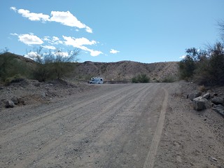
I drove on, planning to get to California using the scenic route south of Ehrenberg, following the gravel levee road of the east side of the Colorado River. I was planning to scout along the way for boondocking spots. As a bonus, I didn’t have to worry about the fruit police taking my Citrus as I entered California. The river road is a little tricky to find, you follow the meridian road south of Interstate 10 at the Ehrenberg exit to what looks like an alley road at the end of the business part. It continues as a gravel road, eventually meeting up with the Colorado River.
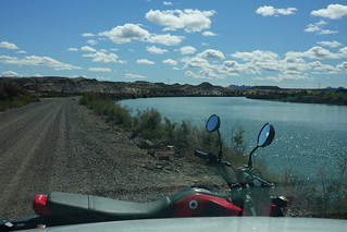
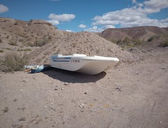
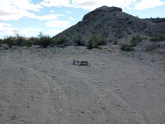
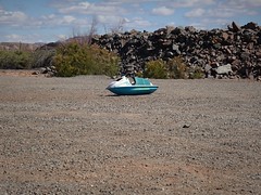
The gravel road is good, but the view is better. I wasn’t in a big hurry so I kept my speed down. Slow is better for the rig, and better to spot boondocking. I pretty much ignored the first few miles from town. The area is sketchy in the easier to get to spots, you see junk and abandoned trailers hidden in the trees. But things improve further down the river. The area is a mix of BLM, State, private and “other” land. Camping is mostly concentrated on the BLM land, although I do see signs of camping on some good State Land spots. I lingered on one spot trying to figure out why no one was there. It’s State Land. You can buy a pass and camp there, but only for 14 days, total for the year! I don’t know how much enforcement is carried out, but I suspect a ranger comes by occasionally judging by the lack of campers on the State bits.
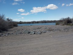
About half way down the river to the bridge that was going to take me over to California I find a boat access area. People camp at these things too, but it is more crowded than I’d like. Driving 200 meters down the road, there is a little gravel lot that could be a camping spot. But a little gravel road leads off to a spot with a firepit. This looks promising. Walking around, I note that the far side of the firepit is soft sand, better stay on the path side of the pit if I don’t want to get stuck. One should always walk around an unfamiliar area first to see if the ground is soft!
Under normal circumstances, I would camp at this point. The area didn’t have too much junk. The offshoot road dead ended just past my spot, and the spot was far enough from the main road. I could carry my kayak down to the water access in a couple of minutes. So why was I conflicted about staying? I had been texting with my new camping friends who were gathering at Joshua Tree National Park. I could have one last get together with everyone before heading back north, or I could stay here and enjoy the water.
I couldn’t believe it, but I was driving away from this spot. It would seem the company of friends had won out over a great spot near the Colorado River. What of this nomad life I thought I’d have in the desert? I thought there would be plenty of time for solitude freezing my ass off back in Canada waiting for proper spring. In the meanwhile, there would be more socializing in the desert for me.
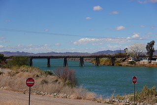
I arrived at my crossing of the Colorado River, the River Road Bridge. One surprise was that the road was paved, both to the bridge from the north, and south to the next bridge. I would have to be back here someday to explore this area further. The south road heads towards Cibola Lake, a set of abandoned channels of the Colorado River, as well as the general Cibola area. Larry had told me about this spot – it was on the ‘next year’ list now that I knew there were reasonable roads to the area.
But for now, it was onto Blythe for my grocery shopping, then Joshua Tree, to see this beautiful park with friends! See you there next time.


