

Logging RR steam engine at Woss
I was on my way south to a new destination. Where? I can’t tell you that, it’s a secret. Even I don’t know the exact location yet, but I do know what State I’m going to. That’s all the clues you get for now. In the meanwhile, I’ll tell you about my first stop heading south on Vancouver Island. I was at the lightly maintained no rules Woss Lake Campground.
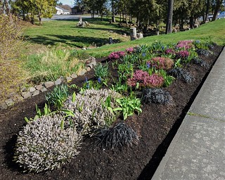
Port Hardy park along Granville St.
I left what I consider the core of north Vancouver Island, the area between Port McNeill and Port Hardy. Spring flowers were out in town, I at least got to see some before I left the area. My last shopping completed in Port Hardy, I headed south. I was not travelling too far this time, headed for Woss on my way to the lake of same name.
In Woss, there is a nice historical display about the former logging railroad that passed through this town. The steam engine is particularly nice, with the history explained in several signs in the area. It’s a good stop for history people, especially rail history. Woss has a general store that should cover your basic supplies, and gas. The next gas station is an hour away. There is no dump station according to the locals I talked to, drat.
The gravel road to Woss Lake is well travelled, so you get some potholes. Just take it easy and you’ll be fine. There are enough signs to find the campground on your own, but watch the googles, the backroads here are not connected properly and it might send you on a long detour to the campground. The correct route goes right through Woss, U-turns left, out of town. Arriving, you go down a steep little bit, nothing too bad, but the road has definitely not seen maintenance in some time. In fact, that is the theme of this campground, little maintenance.

I drive through the center of the campground, going past a mostly fallen cabin with a blue tarp now not holding back much of anything. It’s a mess. The sites look to be where ever people wanted to camp, the sign telling you about the campground rules has fallen over. Or been pushed over, hard to say for sure. I take a look around and see there is a back corner to the left. Checking that out, I see it is a big level area that could hold a couple of big rigs, but there is one nice picnic table there (the only good one in the camp) a couple of fire pits (someone has dragged an extra one over) and a nice view down to the lake.

The view and isolation sell me, this is my spot. It turns out to be not quite as isolated as I thought – the road going down the lake goes by just 100 meters away from me and does have the occasional vehicle. But I do have my own outhouse should I decide to avail myself of the facilities.

Cabin remains
This campsite is another of the WFP sites of which they have cut back over the years, or transferred over to BC rec. The Rupert Inlet site is an example of a site no longer listed that has little more than some outhouses and a boat launch left. Woss Lake still gets a bit of attention. Looking at the outhouses I see that they are not in too bad shape. There has been some recent tree and brush clearing.

The campground sign fallen over. The big puddle is actually the road, also not in the greatest shape
Perhaps some more picnic tables will be supplied, other than my good one there are only a few pretty run down specimens available at other sites. Plus they really need to remove the falling cabins – that is just a hazard the kids will hurt themselves on at some point. I term this an unincorporated campground – no hosts, rules, but no service and only minimum maintenance.
Fishing just below my camping spot
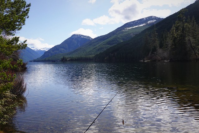
While the state of the campground is only fair, the area around it is great. There is a beach on the lake – not big, but there is real sand, and it goes out shallow for the kiddies to play in. The lake extends to the south, surrounded by hills and mountains. My spot had the best fishing hole right at the campground. Everything to the north where the beach was is quite shallow leading to the Woss River, which exits the lake at the north east side of the campground.
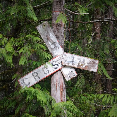
My campsite even has some historical decoration, lets call it. I’m assuming this was salvaged from the logging railroad somewhere around here when they shut it down. You know it’s old because it has been a long time since these signs have had the words ‘rail road crossing’ on them, although it is possible the logging companies were using an alternate design as I don’t recall seeing both the words and the red outlines this one had.

All sorts of signs at the road, but the trail quickly turns to nothing

Woss River view from trail
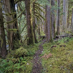 There is a trail starting right at the campsite that follows the Woss River. It is good until it crosses a logging road, then despite all the signage telling you about the trail here, it is blocked with brush and past that becomes indistinct quickly from what I could see. I didn’t feel like getting wet so I did not explore any further to see if the trail gets better again, I really had lost all sign of the trail by the time I turned back. But you can at least do a short loop if you start at the campground, follow the trail to the logging road, then come back via the road to the campground entrance.
There were several logging roads to walk down as well, with Woss Lake having one going down each side. I started with the west side, which looked like it might have some boondocking nearby. While I did end up finding a spot, I found another unexpected local spot.

Beware of (6) dog(s)
I started down one of the side shoots off of the main road, expecting to find a dead end of some sorts, with possible boondocking down it. The previous one I had just been down was exactly that. This road to start with had had some brush and trees cut back recently. Good for getting in, not so good for potential solitude. I reach the end of the road and see there is a good trail going off towards the lake. I’m thinking this road is maintained as a lake access point. I start down the trail to investigate, then see a bunch of brush and tree branches have been piled in the trail. It’s pretty obviously blocking the trail, for it has been maintained recently too. Ahead I see a “Beware of Dog” sign. But looking at it closer, I see a ‘6’ and and ‘s’ have been added, “Beware of (6) Dog(s)”. Some sense of humor I see. I’ve already run into one camp in the bush here, I didn’t want to run into another, not to mention it was wet with the blocking brush making me wetter. I decided seeing if this path lead to the lake wasn’t worth it and turned back.
Next day, I run into Peter, a local who works as a Bosun for the coast guard. He turned out to be an interesting fellow with a lot of stories he couldn’t tell still working for the government, but he could tell the tail of a little flight error one of the services had with some newly acquired surveillance drones. The drones are shipped to Ottawa, assembled and checked out. Then they break them up and ship them out west, where they are reassembled and tested for final checkout. There was a glitch with one of the drones where it lost communication with its controller. Now, normally this isn’t a disaster as the drone has a home base location, and it is supposed to fly ‘home’ if it loses connection to the operator. One problem: they western crew had not yet set the drone to it’s new home location so it was flying east, to it’s old home base in Ottawa! Now these are not small consumer grade drones – these are the size of a car with a range in the thousands of kilometers. Fortunately, the drone did not have a full tank of gas, so it only made it halfway across Western Canada. Upon running out of fuel, the drone did an emergency landing in a farmer’s field. The operators raced to get their drone back, but the farmer found the drone before they got to it and phoned the number on it, stating ‘I believe I have something of yours’. I’d like to catch up with Peter again after his retirement when he can tell a few more stories, I’m sure he has some other good ones!
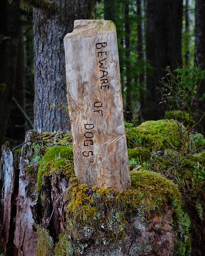 Coming back to my ‘dog site’ I mention this to Peter, asking if there are known squatters around the lake. He didn’t know of any, but he did know what the dogs sign was about. It turns out the locals have created a little beach access of their own to get away from the rowdies who tend to take over Woss Lake Campgrounds during the busy summer weekends. The signs are half joke/half discouragement to go further. He said to feel free to check it out – which I did, I’m always looking to find the little local hangouts. Heading down the same road and trail on a drier day, I pass the brush and the first sign. Fortunately the brush blockage did not extend beyond a few piles, so after that it was easy walking again. I run across a carved wood version of the ‘beware of dogs’ sign, telling me I’ve arrived at the beach.

I see the locals have named it ‘Ficeley Beach’ probably after one of the long time locals in the area. There is yet more warning about the dogs, just in case boaters come along.

There is a bridge and ramp over a large log marking the beach border. I make use of the facility and step onto the beach. It is a small beach, more gravely and not as nice as the campground beach, but I’d take it over a rowdy beach any day.
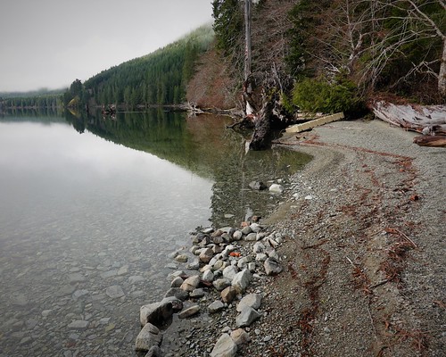
From the tree to the end of the little beach. A bit more on the other side of the tree
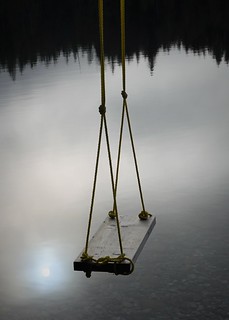 There is a swing overhanging the water, certainly that would be great fun on a hot day to splash from. It’s too bad that the campground has gotten so out of control that the locals feel they have to make their own spot. The effort put in here done on the campground would already improve it quite a bit, but I get why the locals would rather focus on something that is just theirs. Out of respect I’d not boondock in the dead end parking area at the start of the trail because it’s not very big, not much room left for others if I’m there. But other people would not hesitate, nor would they hesitate to set up tents and camp in the locals spot if they braved the dogs. I debated stripping the geocoordinates from the pics so others couldn’t find it, but really I’d have to just not mention it at all then, it isn’t really that hard to find if you go looking down a few roads leading to the lake. Hopefully the rowdy people all find this blog way to boring to have read this far.
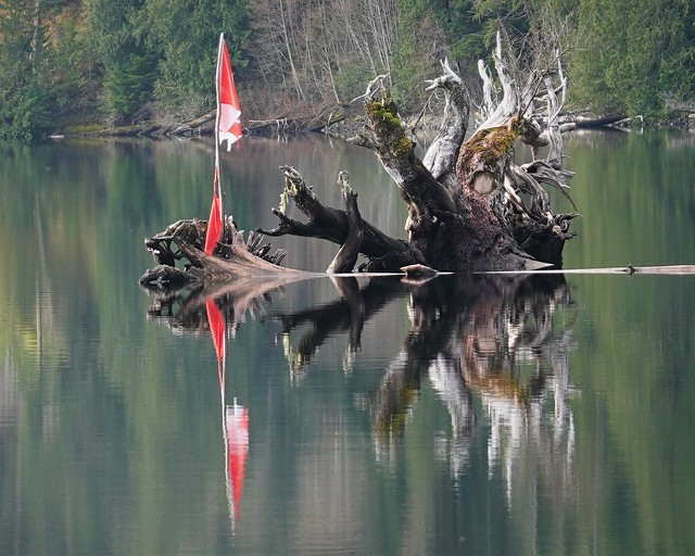
I look out at the water where someone has placed a Canadian flag to mark one of the tree snarls out in the water. The flag is tattered and in need of replacement, like a lot of stuff in the campground.
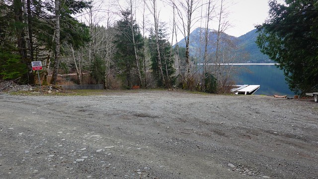
Boat launch on the east side of the lake.
In my wanderings down the east side of the lake, I discovered the boat launch. It’s actually really nice, with a new wood dock and some mooring docks. There is even a ‘grey area’ boondocking spot just on the other side of the road. While the sign says no overnight camping at the boat launch, does the other side of the road with the little offshoot road count as part of the boat launch?
 I tried fishing at the boat launch and gave it lots of tries at my campsite but no fish were hauled in by me. Peter mentioned Woss Lake fishing isn’t that good these days, the other end of the lake might be better. He suggested taking the logging roads to Atluck Lake. There is a campsite there too and the fishing is supposed to be much better. This is one of those things a motorcycle would be really handy for – the lake was too far to walk, but I didn’t want to go camp there just for a day or two out of cell service to try fishing. A motorcycle day trip for a little fishing would be perfect. We will see what the summer brings, I will look into getting something when I’m around Calgary for a while.
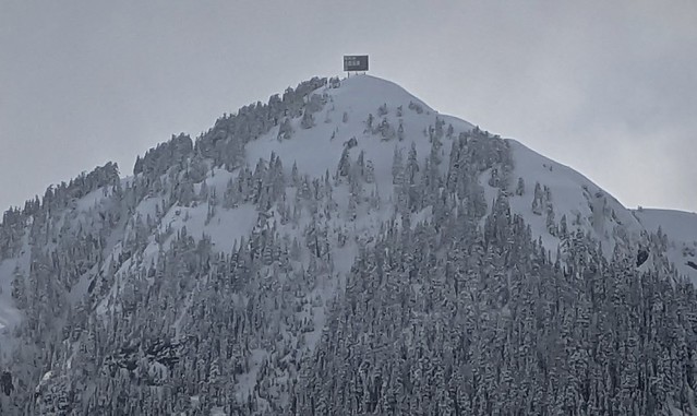
20x zoom with the Pixel 6, so zooming in isn’t going to get you much more detail
From the boat launch, I could see this large ‘bill board’ thing on top of the mountain across the lake from me. I see no human activity around that mountain, so I have no idea what this is for.

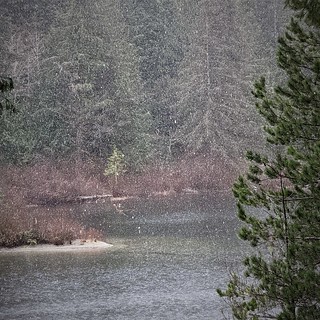
Sent off with enough snow to make driving interesting
The weather turned nasty my last couple of days at Woss Lake. Snow had followed me again, and there was fresh white stuff in the morning. I was continuing south the following day, which the weather forecast only promised scattered flurries. This blizzard this morning is scattered flurries?! But most of it is melting still, so off I go down the highway, which at least ends up being mostly slushy rather than icy at its worst. I just took it easy heading further south, no rush as I was up plenty early to get in my travel, resupply and find my next camping spot. But that will be for another blog entry!
