I woke up early, well, early for me. The inside of the RV was just beginning to lighten up, telling me it was around 7am. I lay there for a few minutes, thinking I might get back to sleep. Then I thought about what I was going to do today – I was going to see the Grand Canyon. There would be no more sleep for me, time to get up and go!
After a quick breakfast, I pack everything up, not really a long process since I had not really unpacked more than what was necessary to sleep for a night. I waited long enough for things to get light as the little maze of paths were a little challenging in the dark – I didn’t want to go the wrong way and end up stuck in a gully my rig could not negotiate!
My drive was to take me down Interstate 40, but I was quickly reminded that this was the Interstate that replaced Route 66 in these parts, the legendary highway trotted out as an example of the American Car culture that developed post World War Two. I’ve seen a zillion pictures of these old gas stations and various other buildings to know I wasn’t particular motivated to stop and detour along the bits of remaining Route 66. On another day, perhaps, but today was all about getting to the Grand Canyon. I ignored all the “Route 66 this way” signs, and concentrated on the Grand Canyon National Park mileage signs, counting down the miles until I would arrive.
My initial research on camping at the Grand Canyon National Park led me to the conclusion that I would find most everything full, at least in terms of what the reservation system for the park showed. What it didn’t tell me is that there were actually lots of first come, first served spots available, especially if you just want to dry camp. Hey, my initial research wasn’t exactly complete! I just checked the reservation system which showed no vacancies, what I missed was that there were no reservations were being taken during the slow period!
I get off the Interstate at Williams, north onto Highway 64, to the Grand Canyon! It is a longer drive off the Interstate than I expected, on what is a pretty low grade highway for something going to such a major attraction! I’d hate to be on this thing in the summer, limited passing lanes, no shoulder, but enough straight stretches that the crazy speed demons would be trying to pass the RVs all the time. But perhaps my driving pessimism is just kicking in.
After what seems a long time, I get to the park gate – I’m actually impatient to get there and see the canyon! I pay my $35 for a seven day pass, and head down the road to the campground. My first concern was actually getting a spot to overnight in the Mather Campground. My worries disappear as soon as the Ranger at the campground entrance tells me that the place was about 20 percent full. I don’t think I’m going to have problems finding a place, even in the only partially open campground! My intention is to walk to the Grand Canyon, even though there are free bus shuttles. I pick a spot located close to what I think will be a quick overland to the road that takes you to the full service campground (much more expensive), and happily trot back down to the self pay station to pay my $18 per night for two nights, the longest I dare stay without worrying about the weather turning cold on me.
My research had warned me that there would possibly be no AT&T cell service at the Grand Canyon. I can confirm that, NO service whatsoever. But I had planned ahead for that, and made sure I had at least loaded a Google map of the Grand Canyon Village. A quick trick rather than formally downloading an offline copy is to just scroll to the area you want on the googles, it is smart enough to cache the area which will be available while you are offline. Just zoom in enough to get the detail you want, and don’t be using it to try and cache the whole Grand Canyon, the cache is limited to what you have looked at most recently, with “recently” being somewhat of an unknown period to me. Using my offline map, I plotted the quickest walk to the Grand Canyon, taking me past the Grand Canyon National Park Headquarters and down a back road to the South Rim Trail. A ten minute walk later, I arrive.
My first views are partial, just seeing an arm of the canyon coming up, but I see to my right the path leads to an ledge that points out at the Grand Canyon proper – I pass through the trees and get my first full view.
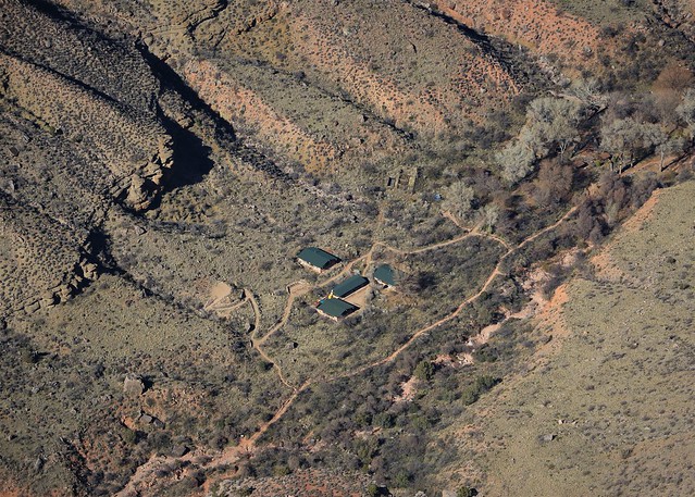
It is an overwhelming experience, at least if you have the self awareness to realize it. You are looking at something so big the mind can not truly comprehend it, like looking up into the stars and not comprehending the distances you are looking out at. Looking down, I know it is a long ways down. But then I notice some buildings way down there.
See them down there? I’ve zoomed in a bit. Too small?
Let me zoom in all the way with the DSLR. I’m looking down as much as over, these buildings are way down there, 1 kilometer down, 1 kilometer over. That is a lot of down in a hurry. Glad my fear of heights is of a healthy respect level of things, or all of this would be making me very nervous. But the drop is so huge, it seems almost abstract in the reality of what is in front of me.
I’m looking at this massive spectacle in front of me, thinking how am I ever going to FART
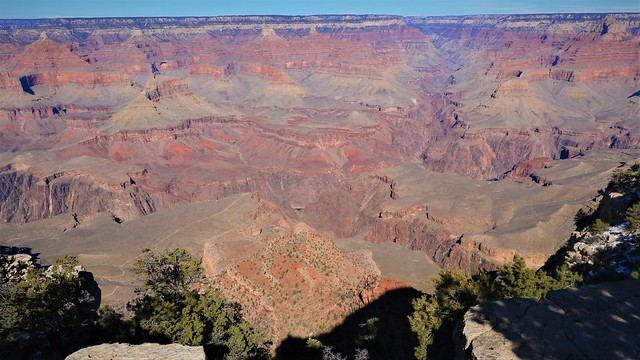
properly to take this all in? There is NO lens wide enough for this, it must be seen in person. Panoramas, 360 virtual reality, nope – not good enough. You need to BE here, to really see this. But I will try. Did you see the Colorado River in the above picture? How could you miss it, it’s a big ass river!
Let me zoom that in for you. This was going from full wide angle to full zoom on my 29-215mm (35mm equivalent) lens. Need to get out the wide angle zoom, going to be using every focal length I can get my hands on photographing here, including 360 photo sphere. But really, I am flailing about here – I am not able to focus on any one thing as there are so many things my mind’s eye sees that I want to capture. There are many more things I know I cannot capture on whatever flat plane you are viewing this on.
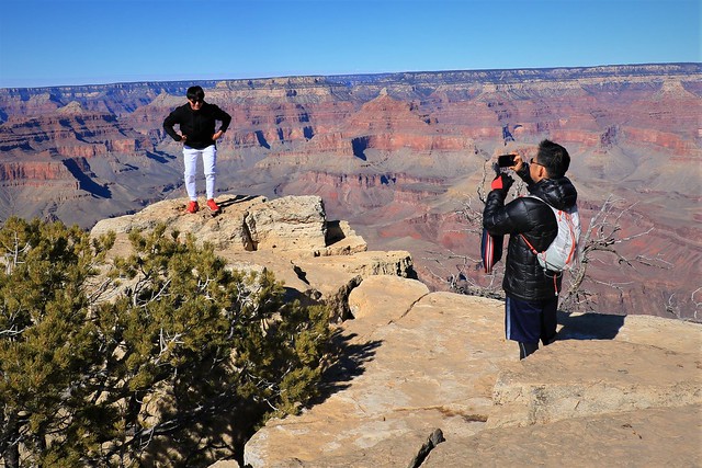
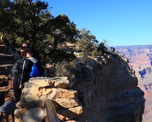
One thing you might forget at the Grand Canyon is people watching. Everyone is trying to get the perfect photo of themselves with the Grand Canyon, you can snap other people with ease, hell, you’re just photographing this big ass canyon and they got in the way don’t ‘ya know? I know people fall off the rim of the Canyon all the time – one step too far back and you’re done. Wonder how many times it ended up in the photo, with their arms cartwheeling desperately trying to regain their balance before falling into the abyss?
Everything is big here, light, shadows, texture – and every which way you look. I could be here everyday for a year and still capture new views in the particular light of a day.
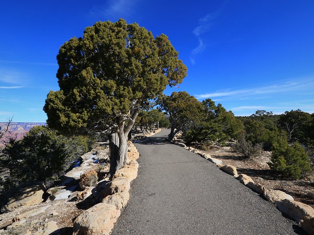
Another thing you might not see much off is what is there other than the Grand Canyon – you are walking along this nice rock lined paved path, with scrubby pines around you. I can imagine in the summer this path is filled with people, but right now it is only the occasional person down here. There are still always people right around the main viewing areas. You’ll note in my photos so far there is no fence – thus people who fall off every year. The most popular areas are fenced, allowing you to be brave and get really close to the edge, but the rest is nothing but air between you and the bottom of the canyon.
I am not really here at the best time to photograph, but it is a sunny day with nice blue sky so the rock color contrasts do light up in certain areas. I noticed in processing this photo I managed to get a bonus feature in, way down where the Colorado river is – you see it? You may have to click on the picture to make it bigger, just remember to close the window to come back here and continue reading. That is a suspension bridge, specifically the Kaibab Suspension Bridge across the Colorado river, a mere mile down there! Yes, you can hike down there from the south rim, and I have every intention of going part of the way to the bridge.
I walk and photograph, being careful not to do both at the same time – that’s a good way to get killed around here. Up ahead, I see a building that turns out to be the Geological Museum – since the path goes right to it, might as well stop in and take a quick look. It is essentially two things: a tourist stop to sell you trinkets, and an educational stop to educate you on the geology of the Grand Canyon. I will give you the really brief whimsical education.
The Colorado River was there, happily meandering about the low plains, when the continent decided to rise up. The river said, “Fuck you continent, I’m happy at the level I am!” “Oh yeah? we’ll see about that!” said the continent, rising the land the river was on. “HAHAHAHAHA, loser, I erode down faster than you can rise up!” said the river. But the continent has not given up, rising up to the 7000 odd foot level we are at today, while the river still manages to erode down where it wants to be. One other lesson in context here – ‘fast’ as in the river eroding down is in tenths of a millimeter per year, and this is over 4 million years. Oh, this is recent by geological standards. You think the canyon is huge? Try thinking in history of the planet time levels sometime.
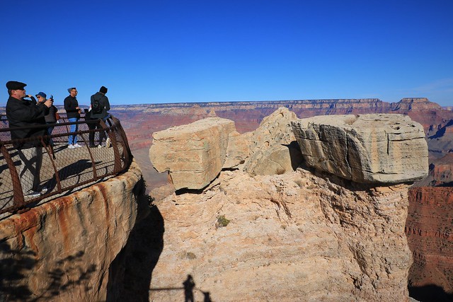
I wander on, still photographing, but really the mid day light has washed out the shadows – nothing to see here! But there are still people, photographing away to be photographed in turn. I have come to the main viewing area here, called Mather Point. It’s close to the parking, visitor center and bus stops. Thus, lots of people, and every good view point is fenced off.
You can see from the fencing here and the people that they do let you come right to the edge. I hope they have an engineer look at the rocks once and a while to make sure that they are still stable. One thing to point out is how the deceiving “level” is here. See the crooked horizon on the right of this picture? But the platform looks pretty level, so WTF? Oh, the horizon really is skewed. Remember, the continent is rising from the west to the east. When I point my camera at the opposite side of the canyon, if I keep it true level, the rim appears to be slanted down to the left, about a degree. Most people framing without a level will just naturally adjust for this and make the photo line up with the rim wall (as I have mostly done). However, you should know every photo is tilted over a degree to the left to make the horizon look “right”. People may appear to be slightly tilted to the right, if you look really carefully.
This point rising up is called O’Neill Butte. I see hints of what might be a trail going over the ridge. Wonder if I might be able to hike down that way?
Looking back at another view point just past Mather I wonder how trusting people would be of that fence, seeing it from the angle I’ve got over here.
But they all have this nice rock column to distract them from the edge of the drop, look at that rock! Don’t mind the drop, nothing to worry about. Of course, my shadow shows me here up against the same railing just over from the rock viewers. I am relying on good American engineering to keep me safe while I’m distracted leaning against this solid looking fence.
I see more contrasts – this one I liked a lot seeing the result in the camera, a bit of tweaking to get the framing I want and a masterful photo is born!
There are so many perspectives – I keep going back and forth in the photos trying to pick one a bit better than the other. Then a bit of tweaking, like this shot, I almost never post a 3:2 ratio shot vertically – doesn’t work well on a monitor, this is cropped back to 4:3, but even that is a compromise. If ya’ll had a second monitor turned in portrait mode, I could really show you some dramatic views down then!
It is 4 pm and I need to start wandering back towards camp, backtracking the way I came. The sun going down is starting to make some more contrasting shadows in the canyon. Like most places, the Grand Canyon does not make for as dramatic photos mid day when the sun is high. In the winter, not so bad but as a summer tourist, I’d definitely try to get my pictures in the first couple of hours of light or before sunset.
The blue haze looking back wasn’t great, but something about the contrasts – turn into black and white and problem solved. Somehow, showing just a little bit of the drop off with the tiny people perched on top shows the scale, at least this is comprehendable compared to even a significant fraction of the whole drop!
The lengthening shadows allow me to use them for dramatic backdrops for what is still lit up.
I have not featured a picture yet of Bright Angel Canyon , because on the way up at 2 pm the sun was shining right into the canyon, and everything was lit up. Boring, yes all lit up – it’s boring. Go back and find the wide angle near the beginning of this post if you don’t believe me, the canyon is there, all flat! Shadows provide contrast, mystery and a sense of depth you will not get with flat light. The Grand Canyon will give you much better photos if you shoot the right thing at the right time.
Since the light was good, this was a good time for round two of selfies. You didn’t get to see the first batch since the light was flat. This one is better. Hey, it is the photographer’s prerogative on what gets shown for a self portrait.
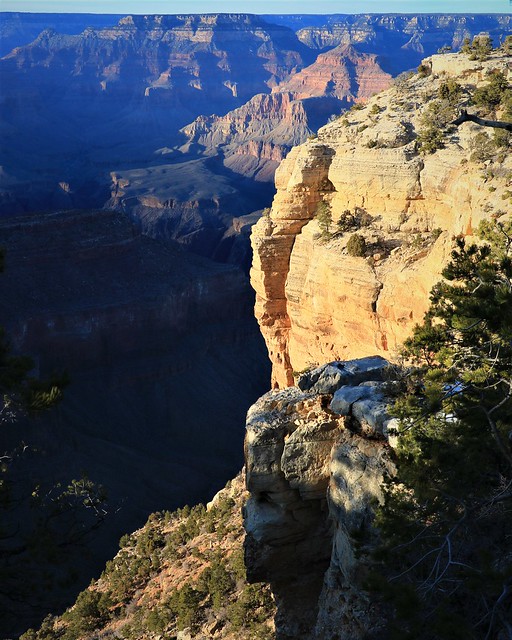
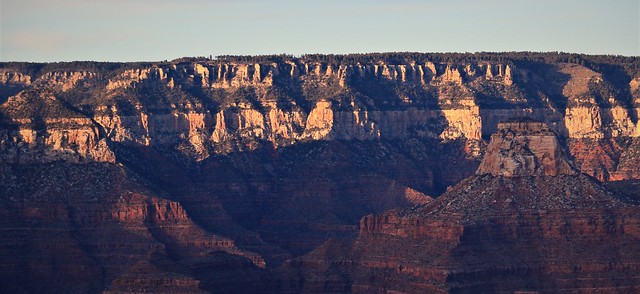
This time it’s the yellow rock contrasted – looks even more yellow with the sun starting to warm up the colors as it goes down.
See the tiny people at the top? I’m probably only looking at the first thousand of a five thousand foot drop. BIG.
A couple of shots in the setting sun to finish off my day. I wasn’t going to be walking down there so I’d have to content myself with some photos. I had about a half hour walk back to my campsite – didn’t really want to do it in the dark the first time. I had tried to convey the Grand Canyon as best as I could today – almost drained the battery on my Canon – that is hard to do in one day! But the photos only show a hint of what it is to be there. Tonight was going to be research a hike based on the paper brochure the park had given me (so old school). Tomorrow – see if I could hike down into the Grand Canyon!


