

One thing I have noticed on this trip is that I plan ahead way less than I thought I would. I seem to be happy just looking at what is up ahead of me, doing a little poking around on my maps. Perhaps I do a little research on the internet. Then I just go, and figure out the rest when I get there. That was not going to work out for me today.
–
I researched my last stop on the criteria that it had to be something between me and Phoenix, and have some hiking from it. I sadly was planning my exit from the desert too, starting to think about how de-RVing was going to work. One of the things I had to do is bring the RV back with empty sewer tanks. A campground with a dump station included would be nice, as I could start my de-RVing day by dumping the tanks, saving one trip I’d have to make along the way. So I pick out a $14 a night campground at Burro Creek for two nights – do a little hike the first day, and a larger hike the second day.
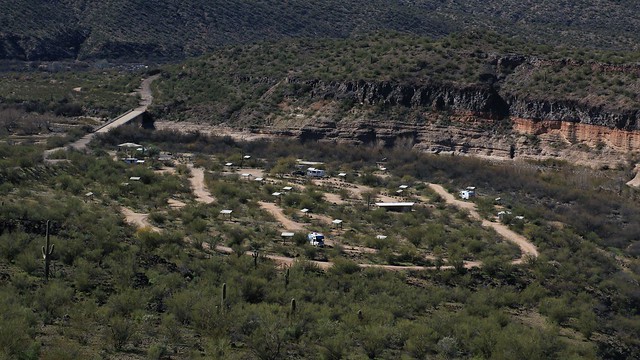
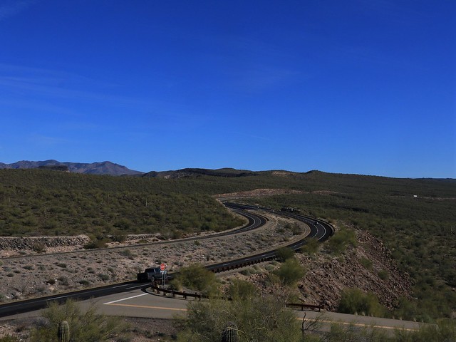
Since it was a short drive down Highway 93, I had almost a full day at Burro Creek Campground which was mostly empty. I drive around the whole site and decide on a spot further from the water but isolated from the few other campers. I head for a short walk before lunch to start with, up the hill with a view of the campground below. Burrow Creek carves a bit of a canyon just upstream of the campground, with Highway 93 spanning the chasm with two arched bridges. The view from this hill gives me what would be the “classic” shot of this bridge that I started this posting out with.
I return to my rig from my short walk and contemplate my longer afternoon hike. There are several springs downstream of my camp. I planned to visit one called “Warm Spring”. Perhaps it would live up to its name and be warm enough to splash around in a bit? However, from my topo app, I can see there is a ranch in my way. Private property can be crossed sometimes, I generally follow the rule of no “no trespassing” signs, no habitation, and no locked gates. I’ll head down and check it out – the roads almost look like I might be able to take a long way around the ranch if required.

From the topo map, you can see that the road I’m walking on is a loop off of Highway 93 (highlighted in red). I am hoping to make it to the circled in blue ‘Warm Springs’.
My internet research tells me that The Burro Creek arch bridge was built in 1965. Previous to that, the road loop that I am on was the highway, looping down the valley to the creek to cross on a much more modest bridge. Beyond the campground I cross Burro creek on the old bridge. The road then becomes un-maintained. I see old pavement, not resurfaced since at least 1965 I now know. It is a fascinating study in how nature slowly erodes away what man has built. The is an outer loop to the road too. Coming to the junction of it, I can see that the highway obviously went out on this loop originally, then at some point as part of highway improvements, the rock here was blasted out to make the shorter inner loop. I do see signs of habitation off in the direction I wish to go. My only hope is that the road branch indicated on the map in the outer loop will take me past the ranch. I’ve already past a sign warning me that I have left BLM land and am now on private land. Not sure that applies to the road; usually the ROW is public land.

I walk down the outer loop, all gravel on this older road. Arriving at my branch, I see there is no going down that road. It is closed and marked private, not to mention the junk pile of a ranch I see is the main destination of the road. I hear dogs barking from there too. Nope, not going that way. But we can continue around the outer loop at least and admire the view. There may be a way around the ranch further up the loop. I am less hopeful on going cross country in that direction – it would be steep terrain to navigate.

I climb up, following the loop back towards Highway 93. The dog barking sounds follow me a ways, so I keep a wary eye out. But ahead it does afford me a nice view of the canyon with the bridge.

I arrive at the top of the loop with Highway 93, no obvious way to be seen until here to go around the property. But you can see here what the original highway would have been like, in the hundred feet that is still maintained to the cattle grate. The other side is 50 odd years of mother nature wearing down the pavement, with a little help from the occasional car coming down here.
I climb up the embankment, following the highway 93 right of way, paralleling the fence that marks the private property. It seems it is going to go on for a long ways, and from my map of BLM land I had consulted, it is several miles up the highway before I might hit public land I can go on. Then I’d have to go across some very challenging country to hit the springs. Or, I’d have to travel even further up the highway to a valley that would take me into Warm Springs Canyon, and my destination. I was not planning on a day hike to this place, and time was getting on. Time to abort this hike and head back. Hopefully the dogs would not be waiting for me on the road, or I’d have to go back and down the main highway, something I did not want to do.

Walking back, I do get a good vantage point of the old Burro Creek Bridge. You can see this is a modest structure, but the highway has to run the big loop to get down to it and back up the other side.

While I hear the dogs in the distance coming back around the inner loop this time, I do not encounter them. Going around the loop, I see the old turn sign – the black edging is strangely worn away everywhere but the corners. The pavement is all rutted with no lines left at all. The battery left on the road is a mystery, recycling lead, anyone? This is what the roads would look like if we disappeared for 50 years I imagine.
I return to my camp a bit earlier than expected since I was thwarted in my attempt to go further afield to the warm springs. Since I have time, I decide to do a loop down to the water and down to the old Burro Creek Bridge.

Since I am by water, I take advantage of the rare opportunity to dip my feet in. It’s cold for swimming, but refreshing for the feet.

The spiders I see on the rocks convince me it’s time to move along. I’m not hugely afraid of spiders, but there were a lot of them around. Better to not have one go up my pants.

I see some signs of spring – green buds, these fuzzy flowery things, new green grass. I contemplate that I’ll be living through two months more of winter returning home before I see such signs up north. I’ll enjoy the preview while I can!

While I did park away from the water, I do at least have a bit of a view of it through the vegetation. There is nice green grass here, I’m sure the cows are happy to munch on the new growth.

Burrow Creek has carved out these large pools here by the campground – they almost seem like small lakes in comparison to the creek. There must be some large violent water flows when rainstorms come to make these big holes.
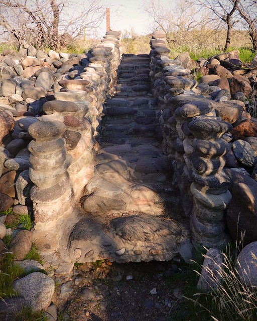
I had been trying to figure out how you were supposed access the creek area from the campground. There is a fence separating the two. But I come across these very elaborate narrow stone steps leading to a gap in the fence. Where I had entered on the far west side of the campground, a ‘V’ fence jog to allow people to pass but not cattle had sufficed. I’m guessing the steps would be a little difficult for a cow to manage, but what about the calves?

I continue away from the water and into the trees. They are still all bare as expected in late January, but the grass is already new green growth underneath. So nice to feel soft vegetation underfoot compared to everything thorny in the desert.

I make my way back to the water, and walk under the bridge. There is lots of sand and gravel here – not a bad beach spot and judging by some of the scrawls on the piers, it has been used in the past.

As I look downstream, a bird lands by the water, looking like it is hoping to snag a fish from the water. My picture is a crop of a small part of the image – He was too far away to get anything bigger than this. It has not been an abundant wildlife trip, but it is the desert, few animals can live per mile of this dry terrain.

On the way back to my RV, I stop in the desert garden at the entrance to the campground. It’s a little trail loop with various desert plants along the way, each with a numbered post by it. The intention is that you grab a brochure at the start of the trail, and read the key to tell you what each plant is, and I assume a little blurb about it. Unfortunately, there were no brochures left, so I was left guessing what most of the plants were.
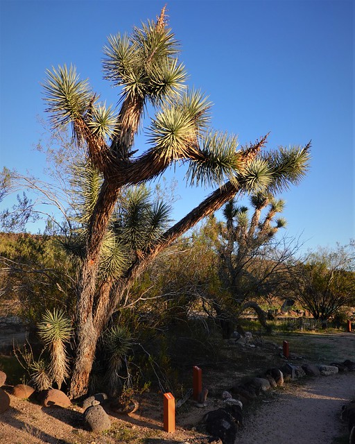
I’m pretty sure plant post #1 is a Joshua Tree. Through the power of the internet, I find that the government has contributed a copy of the brochure to the the googles book service, now I can tell you that is NOT Mohave Prickly Pear Cactus! Yes, I am quite sure the post refers to a plant much smaller that used to be there and the Joshua tree behind it just happens to be nearby.

I walk past the other posts to #7, which concurs with my research and the brochure in being a Joshua Tree. Still, looks a little different from #1?

Some of the plants seem to have died off. I don’t know what kind of care they take, but you can see from the Teddy Bear Cholla that it is not doing that good. At least now I can confirm my suspicions that there are several species of Cholla, all of various forms of ‘ouch’ to touch.

The Spiny Barrel Cactus is looking good! It’s still a good display even with some missing plants. The larger plants such as the Creosote Bush, Saguaro and Ocotillo among others are doing well.
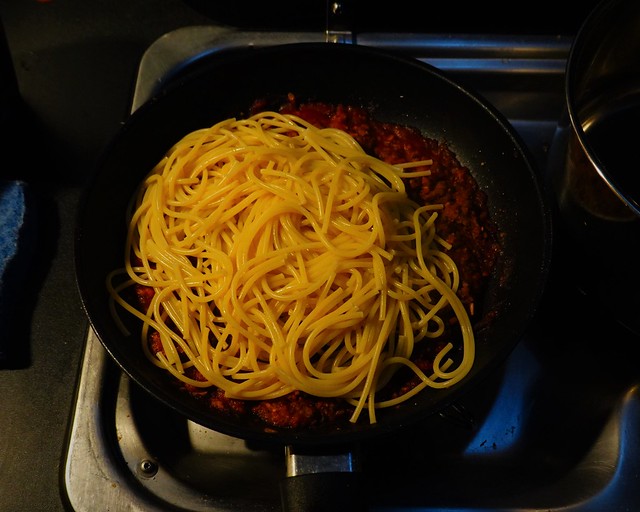
I enjoy my last “cooked from scratch meal”, finishing with the same meal as I had for my first cooked meal: Spaghetti with meat sauce. The plan is to use up the last of the meat supplies I cannot give away. Tomorrow will be a can of something, the rest of which I will give away to Goodwill when I leave.
I never got to my intended ‘warm springs’ for the day, but you adapt and be happy with what you can see in a day. Tomorrow is going to be interesting. My planned hike will have me going through the canyon underneath the Burro Creek Bridge. The walls are very steep in places right down to the water. Would I be able to make it past the canyon to see Hells Half Acre?
