
My tour of Fort Rupert was thrust upon me by some unscheduled off-roading as I explained in my previous post. I was ‘camping’ at the repair shop, with power. At least I was stuck in an area with things to see. My repair shop had beaches within walking distance, if the snow wasn’t too deep! I also had a little convenience store close by, plus the airport hotel down the way had a little liquor store. In terms of being stuck somewhere awaiting repairs, I could do way worse!
My first day there didn’t amount to much – I was waiting to see if my part was coming in or not, so I limited my walk around the area as I might be in the shop and gone pretty quick.

I did make a quick walk down to Story’s Beach, having seen the Kippase Reserve was closed in COVID times. When my part did not show up then, I had a whole weekend to explore around Fort Rupert. The weather had returned to normal for the island, so my explorations were limited by rain. I don’t mind going out in the rain, but I have limits, especially if I’m just going for a walk to kill time. But the rain was eating away at the copious amounts of snow, which I hoped would lead to be being able to head out to some backroads once my repair was done.
On my first walk, I got talking to a lady coming out of the convenience store. I mentioned that I was in town for repairs from going off in the ditch. She had heard about my RV going off the road – seems I was local area news for the day. Of course, this being North Vancouver Island, they don’t see a lot of icy roads close to the water level so vehicles going off the road, especially RVs would be more of a novel thing than in the mountains of Alberta I’m used to.
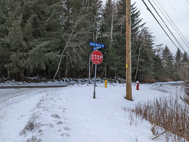
TMX is short for Trans-mountain pipeline – supplying oil for Vancouver from Alberta
The rain did relent for one day, in fact that turned into a pretty nice day. During my walk back to the beach I encountered several of these stop signs. I wonder if the gas shortage up here has got people thinking another pipeline might not be that bad an idea?

Low Tide Beach
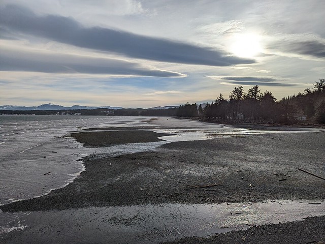
Storey’s Beach was a great expanse of sand and pebbles at low tide, about two kilometers of beach to walk down, if you count the Kippase Reserve as the end of the beach. There was a stiff breeze pushing me down the beach; coming back was going to be chilly.
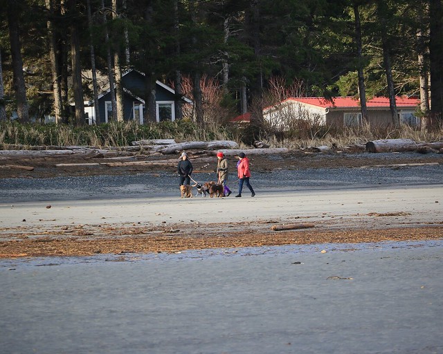
With the sun even coming out a bit, there were even dogs and their people out enjoying what probably was the nicest day of the year so far. Not that that was saying much, considering it was early January and the weather had been crap.

Storey’s Beach Bluff
My goal was to reach the end of the beach and see Storey’s Beach bluff, and perhaps go onto Dreamcatcher Point. From what I could see of the shoreline, now was the time to do it while we were at low tide.

I was following the same path as a lady way ahead of me down the beach. She was going slower than me. I’d fall behind stopping to take pictures, then catch up. She went off between the bluff rocks and the beach to Fairytale Beach, just behind the bluff. I didn’t want to to look like a stalker, so I hung around the bluff for a bit, climbing up for the view. The walker did turn around at the end of Fairytale Beach and come back, leaving me with the view to myself.
I walk over to check out Fairytale beach for myself. The low tide is just low enough that I can walk between the bluff and the water, timing my passage for when the waves are out. The tide is starting to come back up, but I can do the more difficult climb over the bluff on the way back, as long as the tide has not come back up too far.

Fairytale beach and Storey’s Bluff

Dreamcatcher point from Fairytale Beach
The beach turns out to be a small pebble beach – a nice little private nook shielded by the bluff from the main beach.

I see the sign talking about trail maintenance, but I never find much of a trail. I didn’t look too hard, so perhaps I missed something obvious just outside of my search radius. I was not going to hang around for long anyways as the tide was coming up now and I wanted to go back down the beach before the tide was up too far. The going got rocky beyond here anyways – didn’t look like I was going to Dreamcatcher Point.
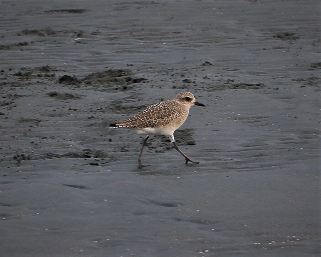
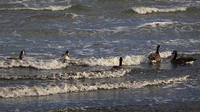
The walk back was indeed a bit brisk in the wind. But the birds don’t seem to mind. The geese just surf over the crashing waves like it’s no big deal. Beats being in the cold I guess.

While messing with some swing photography my beach walker I’d been following returns on another circuit of the beach, providing me an opportunity to use the swing as a frame. They had collected some pipe laying on the low tide sands. Good to see people cleaning up the mess, although in this case it was a perfectly good PVC pipe for salvage.


My day at the beach ended at Beaver Harbour Park, the spot you would park with a car if you were coming to the beach. There are nice picnic and shelter facilities for use here, along with the native and locally peculiar signage. While I wandered about a bit more, I never made it back to anything this nice owing to rain and snow being in the way. But my repair was done – I was headed closer to Port Hardy to wait for a wheel alignment. See you next time when I show you the sights around there.
