I decided for my second week in the desert that I would check out a new area, but nothing too far away from Bouse, where I had some vague plans to camp with Carolyn and friends over the Christmas holidays. I had seen a promising area west of Parker on the way down to Quartzsite. It was outside of the popular area close to Parker, but looked like more of the same camping without all the people. This solitude is what I was looking for. Read on to see what I found.
My week started with a resupply in Parker, this time at the Safeway across the street from the Walmart. As I mentioned previously, the Walmart isn’t the biggest really and I was looking for some nicer stuff to buy for holiday feasting. It turns out the Safeway isn’t that high end either – perhaps slightly more upscale, but smaller than the Walmart so not really that much more selection at the end of the day. It at least provides some extra variety in the area for shopping.
I left Parker, heading west over the Colorado River. Hello California! While I’m technically in California, functionally, this bit of desert is just an extension of Arizona. Everyone in the area goes back into Arizona to Parker for any services. In California, Vidal Junction is the first thing you hit for a town, and it is small. It’s biggest ‘service’ is an Agricultural Inspection station, which I wanted to avoid with my fruit freshly bought for weekly consumption. But there is a good 15 miles of desert to camp in before you get to the inspection station, and I intended to turn off well before the station to camp.
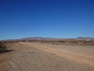
I drove down Highway 62, past all the boondockers to the north. I had scoped out a couple of potential spots. I turned at the first one closest to town, but past the last of the boondockers I see from the highway. Driving in towards the Whipple Mountains, I pass one RV near the highway. I see nothing ahead which is promising for solitude, but not so promising for camping spots. Passing a little road junction, about a half mile on I note a little spot off to the left a couple of RVs could easily pull into a few hundred feet.
Coming to a junction that is the road following the Colorado River Aqueduct, I followed the gravel road west, hoping to meet up with my second spot without going back to the highway. The road is quite good until I came to a dip. I saw ruts ahead and stop to check it out. The gravel had turned soft and deep, extending out over a bit of rough wash. If the soft bit were short and smooth, I could have powered through with momentum, but this was a little more than I wanted to risk, especially with an alternate route available.
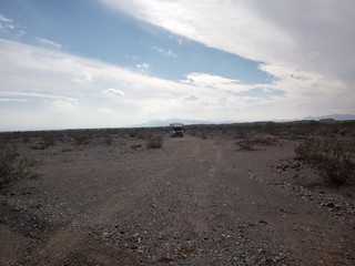
I backed up a few hundred feet to a branch road I used to turn around properly and headed back the way I came. I stopped at the spot I noted on the way in. It looked pretty good, lightly used, no trash, a bit off the road, and only the one RV way off in the distance I passed on the way in. I decided that further exploration is not going to yield me anything better, and drove in, parking myself at the end of the disturbed area. I’m level, I have cell signal, and solitude. Good enough, I was parked!
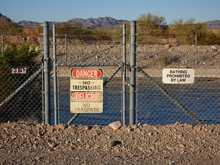
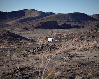
The area I was parked in was BLM land, according to FreeRoam and the BLM land map. But the area to the north of me along the aqueduct was “other” land about a half mile wide strip along the aqueduct. This usually means private land, but in this case it is the ROW of the aqueduct. The operators of the canal would decide what is and is not allowed in the ROW. Only the actual aqueduct road has signage informing you that this is a private road and that access can be revoked at anytime. The structures all have signage that amounts to ‘stay away’. You’re not even allowed to loiter near the structures that are above the underground part. That had me taking my picture, and quickly leaving the area, lest I be accused of ‘loitering’.
Once you are outside of the aqueduct roads that bracket either side of the waterway in most places I saw signs of camping within the half mile strip. It would seem that this is one of those grey areas where you can camp because you have not been told you can’t. I also saw a couple of vehicles camped in the ROW back closer to Parker. The ranger came along one day and didn’t boot them out of their camping spot, so at least BLM rangers were not kicking people off. So you are probably safe to camp, as long as you stay away from any aqueduct infrastructure.
But I didn’t know all this at the time I was picking a spot to camp for a week, so I kept on the safe side of things and picked a spot that was outside of the ROW, on the BLM. I didn’t need to take one of the spots I saw in the ROW. I was close enough to the hills to hike over to the nearest ones, and I could take the Grom out to many other roads nearby. About the only downside was the flat terrain all the way back to Highway 62 did not quite block the noise, even a mile away.
The area I was in backs up against the Whipple Mountains Wilderness, a rugged set of hills with a smattering of mines and roads. The roads are more suitable to 4x4s rather than RVS for the most part north of the aqueduct. I explored many, looking for a remote boondocking spot I could take the RV to. I found one spot, but the cell service ends just before you get to it, drat! I saw another spot, with an RV in it! It looked nice, but it is open on the high plain. You could see him from my camp a mile away, so he wasn’t exactly hidden!
I took the Grom west down the Aqueduct a ways. Where I was, the water ran underground, but I could see on the googles aerial that the water was above ground a couple miles down the road. I figured I might as well visit the water, as any water is novel in the desert. I’m looking at a good portion of the water that the Los Angeles to San Diego area uses. It is even more impressive knowing this water is pumped up several times to cross mountains.
Think about that next time you let your water run while you brush your teeth.
Taking the Grom west, I crossed the Aqueduct and explored some 4×4 roads leading to mines. I could have gone many miles into the wilderness, but I keep myself restricted to a distance I can walk back from should the Grom die. I still have a lot of area I can explore even with that restriction.
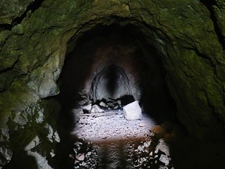
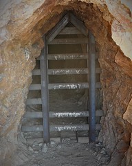
There are several shafts in the area. Some are barricaded, others are wide open. I braved the one, seeing a ventilation shaft ahead with light streaming down from above. At that spot the shaft branches left and right. My feeble cell phone flashlight was not quite able to discern if the shafts ended quickly or went on a ways. I wasn’t going to risk going further as some rocks made the navigation more than the stroll down the flat entry passage. The rocks here were not particularly pretty anyways, so I had no motivation either to go on.
Then there are the unexplainable WTF things:

Rock markers were everywhere, even out in the middle of nowhere, with no roads nearby. I found no gold by any of these.

TV antenna on top of a hill. No way to drive up here. Need about a quarter mile of cord to get back down to a drivable spot.
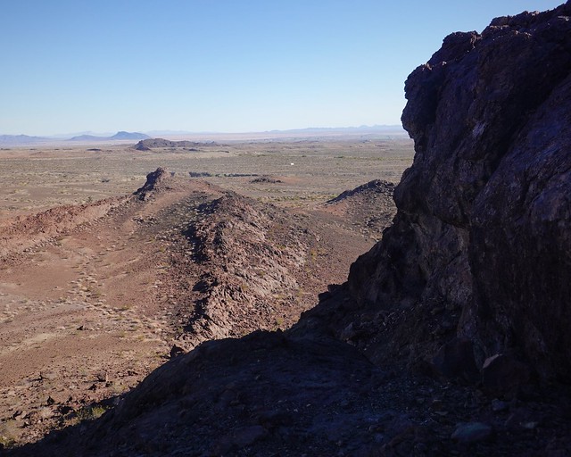
The desert is full of mysteries, and some great views if you climb the hills.
My climb up to the first “mountain” of the Whipple Mountains was not too tough, but my legs reminded me I need to do more hiking like this to stay in shape for the real mountains! The view was great, showing me all the campers closer to Parker on the north side of highway 62, and the few of us further away on the road I was in on.
The Grom went for a ride in civilized country too, going a little ways down towards Big River. I rode down more to get a little practice riding in light traffic. Big River is sparsely populated away from the Colorado River. You have streets with one house built on them. This is not an uncommon thing in the States – developers wildly optimistic about the sales potential of their lots out in the middle of nowhere way over build for the demand. The result is less desirable communities that sell only a fraction of their lots. These communities are way too spread out to walk to anything, enforcing the car centric lifestyle.

Big River is part of the native reserve along the Colorado River here. The natives are not immune to over optimistic development either, but at least it is bring in some income for them rather than some fat cat developer tycoon.
 I had a good week of hiking, motorbiking and relaxing in solitude west of Parker. My next week was planned to be out by Bouse, along an area of Plomosa Road I had noted RVs camp along. This is further northeast of the Quartzsite area Plomosa BLM. Being away from Quartzsite, this area had no restriction on how far you could go in. Join me next time to see how remote I got for Christmas!

